Old Chain of Rocks Bridge on Route 66
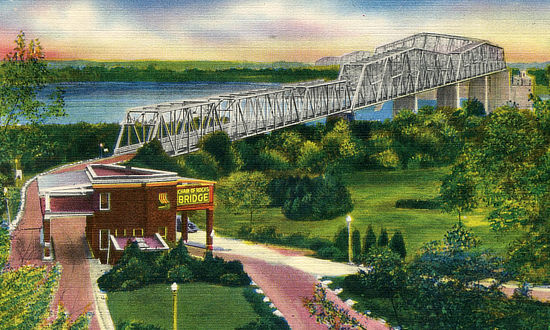
The historic Chain of Rocks Bridge spanning the Mississippi River on the north edge of St. Louis, Missouri was opened in 1929. The eastern end of the bridge is on Chouteau Island, (part of Madison, Illinois), while the western end is on the Missouri shoreline. The bridge was part of U.S. Route 66 and linked two states: Illinois and Missouri. The bridge is short and narrow, only 1 mile long by 24 feet wide. It towers more than 60 feet above the water, and features a unique 30-degree turn midway across the river. Construction cost of the bridge was over $2.5 million, twice its original estimate. The bridge had beautifully landscaped approaches. A park-like setting around a pool and a large, ornate toll booth anchored the Missouri end. On the Illinois side, 400 elm trees lined the approach. The bridge brought travelers into St. Louis by way of the picturesque Chain of Rocks amusement park on the Missouri hills overlooking the river. The bridge became an official part of the Route 66 system in 1936, when the Mother Road was rerouted over the bridge. In 1966, the New Chain of Rocks Bridge was built immediately to the old bridge's north in order to carry I-270; the old Chain of Rocks Bridge was closed in February of 1970. The bridge is currently open daily for pedestrians and biking; permits are required for automobile traffic for special events. Current status, parking information and alerts about the bridge at the Great Rivers Greenway website Old Chain of Rocks Bridge Parks Opening Celebration - April 14, 2024 Vintage view of the Chain of Rocks Bridge |
|
Bridge entrance in Illinois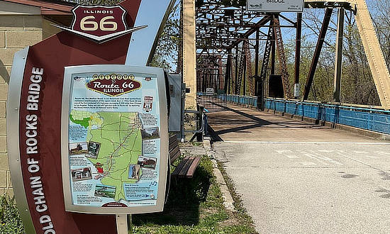 |
Old Route 66 signs on the bridge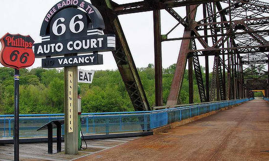 |
Map of St. Louis Route 66 AligmentsIncluded below is a map showing the various alignments of Route 66 around St. Louis over the years, courtesy of Explore St. Louis. It shows the connection with the Old Chain of Rocks Bridge (upper right). For a larger version of the map and more St. Louis Route 66 visitor information/attractions, visit Route 66 at Explore St. Louis |
Interactive Map of the Old Chain of Rocks Bridge
Best-Selling Route 66 Books and Maps at our Amazon Store |
|
| Route 66 Travel Guide - 202 Amazing Places by Mark Watson  |
Route 66 Full-throttle Adventure Handbook, by Drew Knowles  |
| EZ66 Guide for Travelers (5th Edition) by Jerry McClanahan  |
Rand McNally 2026 Road Atlas Large Scale Spiral Bound  |
About These ProductsThe Route 66 Road Trip website is a participant in the Amazon Services LLC Associates Program, an affiliate advertising program designed to provide a means for sites to earn fees by advertising and linking to Amazon.com and affiliated sites. Amazon offers a commission on products sold through their affiliate links. There is no additional cost to you. |
|
Road Trip Travel Guides for Various States Along Route 66
Need help and ideas when planning your road trip on Route 66? Here are travel guides and reviews by state...
 |
 |
 |
 |
 |
 |
 |
 |

