Route 66 Facts and Frequently Ask Questions (FAQs)
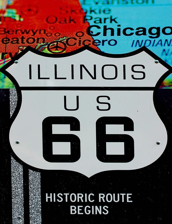 Historic Route 66 begins in Chicago, Illinois, and ends in Santa Monica, CA |
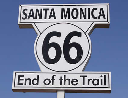 |
Where did Route 66 start and end?
Route 66 began in downtown Chicago, Illinois, and ended in Santa Monica near the Pacific Ocean in California.
How long was U.S. Route 66?
It is generally accepted that, from beginning to end in 1926, Route 66 traversed 2,448 miles, or 3,940 kilometers. However, as the route evolved over its 60 years of existence with new, improved alignments, the mileage varied over time.
Was Route 66 the longest national highway?
Route 66 was not America's oldest or longest road, surpassed by transcontinental highways like U.S. Highway 40 and the Lincoln Highway. But it was the shortest, year-round route between the Midwest and the Pacific Coast. Route 20 is the longest U.S. highway, spanning 3,365 miles.
Was U.S. Route 66 paved?
When Route 66 was officially opened in 1926, only 800 miles were paved, the rest being graded dirt, gravel, bricks, or planks of wood planks. It took 11 more years before the road would become the first national highway to be completely paved.
When was U.S. Route 66 assigned and established?
The numerical designation of "U.S. Route 66" was assigned on April 30, 1926. Its supporters originally sought the Route 60 designation, and after opposition from several states, Route 62. But it finally, officially became Route 66.
"The Mother Road" was officially established on November 11, 1926, and ultimately stretched 2,448 miles (3,940 kilometers) from Chicago to Los Angeles.
Who named Route 66 "The Mother Road"?
In his Pulitzer Prize-winning 1939 novel “The Grapes of Wrath,” John Steinbeck wrote a chapter about Dust Bowl migrants traveling Route 66, which he nicknamed “The Mother Road." The highway is also sometimes called "The Will Rogers Highway" and "The Main Street of America".
Who is considered the father of Route 66?
Cyrus Avery was a Tulsa businessman who promoted the establishment of the Route 66 highway, earning him the nickname “Father of Route 66". In 1927, while involved in founding the U.S. Highway 66 Association, he created the Route 66 byline “The Main Street of America.”
What states does Route 66 travel through?
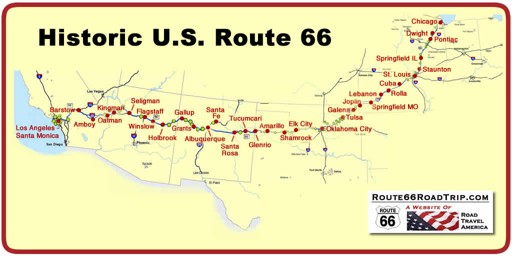
Route 66 traverses eight states: Illinois, Missouri, Kansas, Oklahoma, Texas, New Mexico, Arizona, and California.
 |
How long does it take to drive Route 66 from start to finish?
This question is asked often ... but is difficult to answer. Total time to drive the route, assuming no stops, is in the 32-38 hour range. But we would never recommend doing that.
On some of our road trips across the USA, we drive 500 miles a day, or more. At that rate, we could drive the entire Route 66 in about 5 days. But we would never do that!
We like to take it slow, stop to visit attractions, and catch all those great photo ops on The Mother Road! As an example, on our recent road trip in 2024 on Route 66 in Oklahoma, Google Maps estimated travel time on our trip from Tulsa to Joplin, Missouri, to be 1:45 ... but in actuality, it took us 8 hours!
For leisurely trips on Route 66, many experienced travelers recommend planning for 200 miles a day, at least on those stretches with lots of attractions, like Illinois, Oklahoma and Arizona. At that rate, the trip across the entire length of Route 66 would take 10-12 days.
 |
Ideally, plan on a minimum of 10 days to make the trip from Chicago to Los Angeles. However, for a more leisurely and complete trip you might want to plan for 14-21 days, or longer. It all depends on how many stops you take along the Route, side trips like to the Grand Canyon, and of course the weather.
Which states had the longest, and shortest mileage, on Route 66?
New Mexico had the most miles, and Kansas the fewest:
- Illinois - 301
- Missouri - 317
- Kansas - 13
- Oklahoma - 432
- Texas - 186
- New Mexico - 487
- Arizona - 401
- California - 314
- TOTAL - 2,448
When is the best time to travel Route 66, weatherwise?
Route 66 travels through vastly different climates, from the mid-western plains and cornfields to dry, arid areas in the west, from near sea level in California to the 7,000 foot peaks along the Continental Divide. Thus, weather conditions are diverse, and sometimes unpredictable.
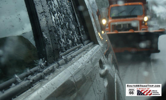
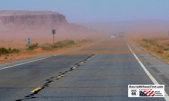
Travelers will on occasion experience snow storms, dust storms, thunderstorms, flooded roads and high winds. So watch the weather forecasts, and adjust your itinerary appropriately.
 |
 |
That said, the most ideal weather for the trip is in the spring, from March into early June. Likewise, the fall months of September, October and November are typically pleasant and offer good driving conditions. Winter months in the north can produce ice and snow storms, while summer in the desert areas of the great Southwest can be hot.
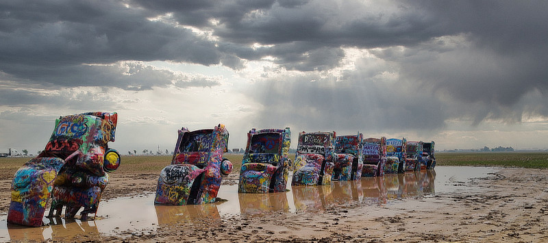
| It isn't always a sunshine day at the Cadillac Ranch just west of Amarillo, Texas ... from May 1 - June 12 of 2023 parts of the area received over 10 inches of rain! |
 |
How can I find Route 66 segments today? What books & maps are available?
Many states have a system of well-marked signs, directing travelers on/off the segments. Also, there is a wealth of paper-based books and maps today that mark Route 66 segments, like the popular "EZ66 Guide for Travelers" and "Here It Is": The Route 66 Map Series" offered at Amazon and other outlets.
Popular Route 66 resources for your next road trip! |
|
Route 66 Travel Guide - 202 Amazing Places
by Mark Watson |
Route 66 Full-throttle Adventure Handbook, by Drew Knowles  |
| EZ66 Guide for Travelers (5th Edition) by Jerry McClanahan  |
Here It Is! Route 66 Series of 8 Maps by Jerry McClanahan and Jim Ross  |
| Rand McNally 2026 Road Atlas Large Scale Spiral Bound  |
The Best Hits on Route 66 ... 100 Essential Stops on the Mother Road, by Amy Bizzarri  |
About These ProductsThe Route 66 Road Trip website is a participant in the Amazon Services LLC Associates Program, an affiliate advertising program designed to provide a means for sites to earn fees by advertising and linking to Amazon.com and affiliated sites. Amazon offers a commission on products sold through their affiliate links. There is no additional cost to you. |
|
 |
|
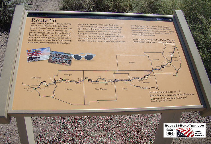
Route 66 ... Through Eight StatesShown here is signage at the Painted Desert marking the path of Route 66 through eight states, and through this area. It reads, in part ... "Gaze down the long road and listen. You may hear echoes of the past ... echoes of Route 66"
|
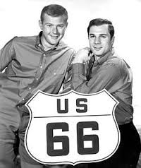 Tod and Buz (By CBS, or Screen Gems) |
Who wrote the song "Get Your Kicks on Route 66"?
The song "Get Your Kicks on Route 66" was composed by songwriter Bobby Troup in 1946. It was first recorded by Nat King Cole, and sung by other singers over the years including Chuck Berry, Perry Como, and the Rolling Stones. The song lyrics follow Route 66 from Chicago to Los Angeles.
Was there a TV show about Route 66?
A popular television show during the early 1960s bore the road's name: "Route 66". Starring George Maharis as Buz, and Martin Milner as Tod, the two young adventurers drove the road in their Corvette for 116 episodes.
Despite the name of the series, most episodes did NOT take place on the historic road, but in 25 different U.S. states. The show was filmed mostly on location, and became known for its cinematography. The show ran from October, 1960, through March, 1964, and created a huge following.
 |
When was Route 66 decommissioned?
With the advent of the Federal Interstate Highway System, U.S. Route 66 was gradually decommissioned, with the last segment, in Arizona, being removed from the Federal system on June 27, 1985.
What highways replaced Route 66?
 |
The passage of the Federal Highway Act of 1956 was the beginning of the end for Route 66, and gradually segments were replaced with new, safer superhighways. Route 66 was replaced by five Interstates: I-55 from Chicago, I-44, I-40, I-15 and finally I-10 into Los Angeles.
What is the Route 66 Centennial?
Route 66 was one of the United State's first continuous stretches of paved highway, and served as a major path for those who migrated west. "The Mother Road" was commissioned on November 11, 1926, and ultimately stretched 2,448 miles from Chicago to Los Angeles.
In 2026, the nation will be celebrating the Route 66 Centennial ... 100 years of the Mother Road serving the traveling public! Many states and organizations are planning special events and tours to highlight the 100th Anniversary of U.S. Route 66.
Can the entire Route 66 still be driven today from begining to end?
Today, only portions of the original Route 66 can be driven. However, a significant amount of mileage in all eight Route 66 states is available for touring. For example, in New Mexico about 265 miles of Route 66 are still drivable.
Some segments remain much as they were originally constructed; other segments have been taken over by Interstate highways. It is estimated that up to 85% of the original route is drivable today. Most remaining segments are paved.
What influence did Route 66 have on the movie "Cars"?
The animated movie "Cars" produced in 2006 tells the story of Route 66 through characters Lightning McQueen and Sally and their escapades at Radiator Springs, a fictionalized representation of all Route 66 towns.
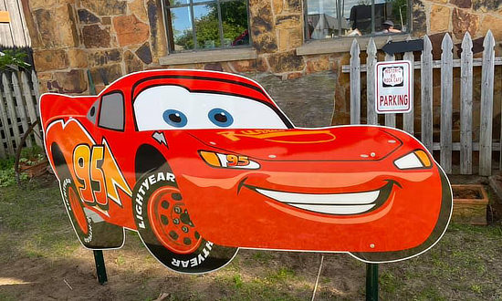 |
Sally liked to say ... "Those were the days we traveled to have a great time, not to make great time"! In the movie, Ramone's House of Body Art looks amazingly similar to the U-Drop Inn in Shamrock, Texas.
Other real-life locations that inspired parts of the movie at the Cadillac Ranch, the Wigwam Motels, and the Wagon Wheel Motel. The movie was produced by Pixar and distributed by Walt Disney Pictures.
What was the highest point along Route 66?
At Continental Divide, New Mexico, Route 66 reached its highest point, with an elevation of just over 7,200 feet.
Are there any historical structures left on Route 66?
There are more than 250 buildings, bridges, road alignments and other sites along Route 66 that are listed on the National Register of Historic Places and can still be experienced today.
Is buying gasoline along Route 66 a problem?
In most places, no. In more populated areas like Illinois, cities and towns are close together, and gasoline stations are plentiful. However, in the western U.S. travelers need to be mindful of their fuel levels. We make it a habit when traveling in West Texas, New Mexico, Arizona and California to keep our tank above the half-way mark. In these areas fuel stops may be 30-50 miles apart, so plan ahead. And each year more EV charging stations are available; but again, check before your trip.
 |
Where are the drive-thru arches and shields along Route 66?
Let's face it ... many of us traveling on Route 66 love selphies! A popular locale for selphies are drive-thru arches, offering an opportunity to capture on "film" not only travelers, but their vehicle, whether it be a car, motorcycle, bicycle, SUV ... whatever. Here are three popular drive-through arches and shields that Route 66 travelers will encounter during their road trips!
 |
What time zone is Route 66 in?
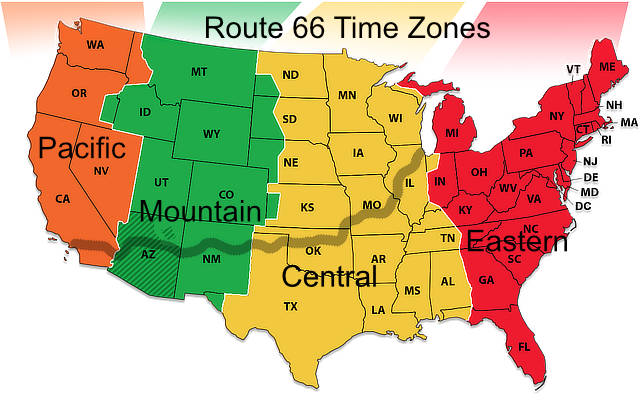
Portions of Route 66 are in three time zones: Central, Mountain and Pacific, as shown in the map below. Daylight Savings Time (DST) is observed from the second Sunday in March until the first Sunday in November. Arizona does not observe DST, with the exception of the Navajo Nation, so check for local time depending on where you are in Arizona.
 |
 The 10-Minute Trip Across Route 66 |
I have never taken a Route 66 road trip. Can you give me a quick overview of what I might see?
Along the length of Route 66, there are hundreds, probably thousands of attractions. And there are dozens of cities and towns to explore.
While many are experienced Route 66 travelers, there are others who are planning their first journey, which from Chicago to Santa Monica can take from several days to two or more weeks. And they do not have a good vision of what they might see on the trip.
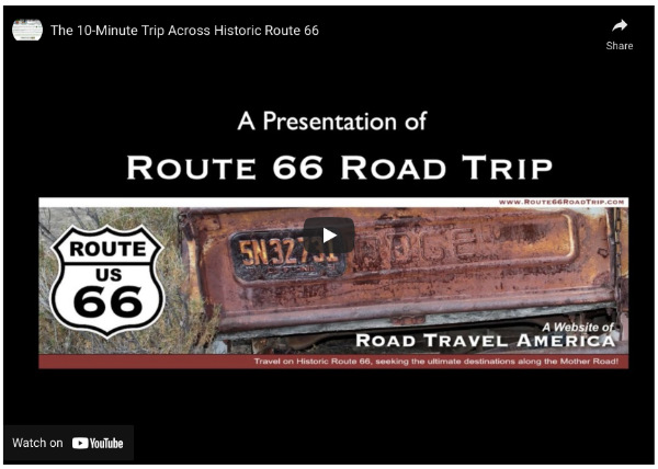
So we have prepared a video to showcase the route, by state, highlighting just a few of the hundreds of attractions along the way.
While some trips on Route 66 take 10 days, this trip only takes 10 minutes! So sit back and get your kicks on Route 66 ... and turn up your volume for some easy-listening music!
Is it true that Route 66 can play "America the Beautiful"?
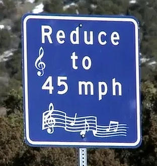 |
Yes! There is a stretch of Route 66 near Tijeras, New Mexico, that when driven eastbound the road plays the "America the Beautiful" song. If you drive the speed limit of 45 mph for the quarter-mile stretch along the rumble strips, you can hear the song play through the vibrations in your car's wheels.
The singing stretch of road is located just outside of the town of Tijeras, NM, just east of Albuquerque, on eastbound Route 66. You can hear the song only when eastbound, not westbound.
The section of the Mother Road is located near I-40 exit 170; drive east about 3.5 miles on Highway 333/Route 66. Hear the song between mileposts 4 and 5, shortly after Route 66 crosses to the south side of I-40.
Today, in 2026, as the pavement has become worn over time, the music is not so loud, but still can be heard by the careful listener. And be on the look out for that new musical highway in Winslow, Arizona playing "Take It Easy"!
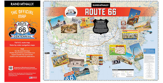
Route 66 Centennial MapCelebrate 100 years on America's most iconic road with The Official Map of the Route 66 Centennial. This definitive travel guide and cherished keepsake honors the Mother Road's 100th Anniversary (1926-2026). The map has been designated an Official Route 66 Centennial Project by the Route 66 Centennial Commission. |
What are some Route 66 City & State Slogans and Bylines?
| Where The Road Begins | Illinois |
| Route 66 Mural City | Cuba, Missouri |
| Birthplace of Route 66 | Springfield, Missouri |
| Capital of Route 66 | Tulsa, Oklahoma |
| Route 66 Midpoint Corridor | Tulsa to Oklahoma City |
| Midpoint of Route 66 | Adrian Texas |
| Birthplace of Historic Route 66 | Seligman Arizona |
| Heart of Route 66 | Kingman Arizona |
Elvis and friend on a break at the Rusty Bolt on Historic Route 66 in Seligman, Arizona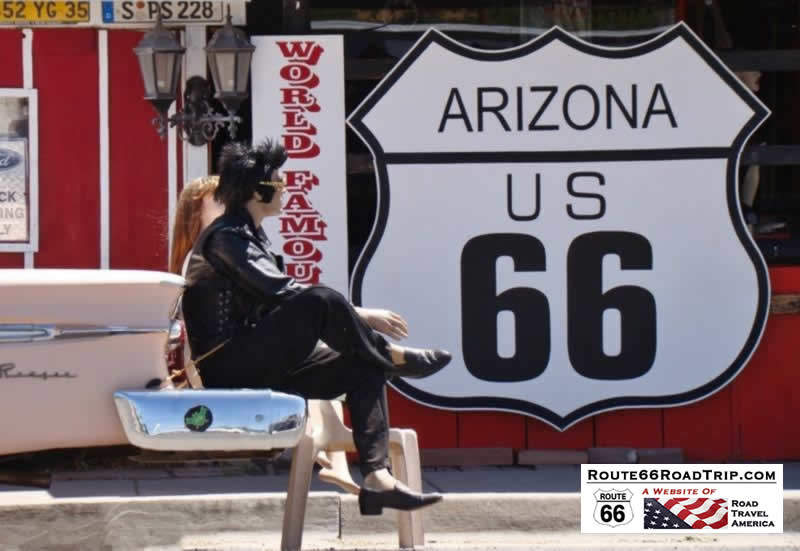 |
Travel Guides for States and Cities Along Route 66Planning a Road Trip on Route 66? Here are trip planners for major segments and cities ... click any image for details! |
|
||||||||||||
|
|||||||||
KANSAS ROUTE 66 |
|
 |
 |
|
|||||||||||||||
TEXAS ROUTE 66 |
||
 |
 |
 |
 |
 |
 |
NEW MEXICO ROUTE 66 |
||
 |
 |
 |
 |
 |
 |
ARIZONA ROUTE 66 |
|||
 |
 |
 |
 |
 |
 |
 |
 |
CALIFORNIA ROUTE 66 |
||
 |
 |
 |
 |
 |
 |
 |
Download our free Route 66 Travel Guide (PDF) |
More Popular Road Trips on Our Other Website |
||
 |
 |
 |
 |
 |
 |
