Trip on Route 66 to Rolla, Missouri
 |
Route 66 across Missouri features a variety of large cities and small towns, connected by roadways over rolling hills and valleys. The Mother Road followed much of the Kickapoo, or Osage, Trail, an Indian trail that later became the Old Wire Road.
Like other Route 66 segments, the actual alignment varied over the years as engineering improvements were constructed.
We've driven much of Route 66, including multiple segments across Missouri.
One of our favorite stops along Route 66 in Missouri is the City of Rolla. It is centrally located within Missouri, at the intersection of I-44 and State Highway 63. The city lies less than 100 miles from St. Louis, Jefferson City, Columbia and Springfield. The city has about 20,000 residents, and is the county seat of Phelps County.
Nestled in the south central Ozarks Highland region, the Rolla is home to Missouri University of Science and Technology, Missouri’s premier technological research university.
Its parks system boasts over 304 acres including over 10 miles of walking trails, outdoor water park and state of the art indoor fitness complex. Rolla boasts a history that predates the Civil War, and has strong influences from U.S. Route 66 which traversed the city.
 |
Attractions and Things to Do
- Mark Twain National Forest
- Fugitive Beach
- Route 66 Museum of Phelps County - in the Mule Trading Post
- Ozark Actors Theatre
- Route 66 Summerfest
- Rolla Lions Club Den & Park
- Edward Clark Museum of Missouri Geology
- Leach Theatre
- Stonehenge at Missouri S&T
- Dillon Log House Museum
- Historic Phelps County Courthouse
- Historic Main Street Footbridge
- Frisco Engine 1501
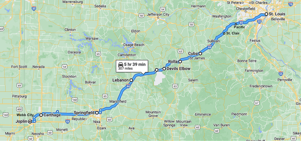
Map showing the location of Rolla, Missouri on Historic Route 66, between Cuba and Lebanon
Earlier Days of Route 66 Around Rolla
Route 66 through Phelps County replaced Route 14, a graveled "all weather" road. Paving work began in 1928, and the final section to be paved was between Rolla and Lebanon, near the town of Arlington.
The "classic" period of Highway 66 lasted barely two decades before realignments, lane additions, and other improvements in the 1950s left the highway looking much like Interstate 44, which was completed in the 1960s.
On Federal Highway 66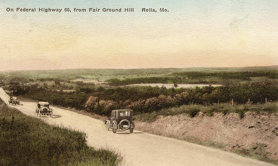 |
U.S. Highway 66 Through Rolla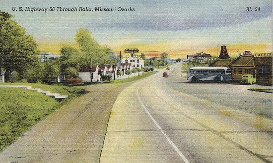 |
Hooker Cut on U.S. Highway 66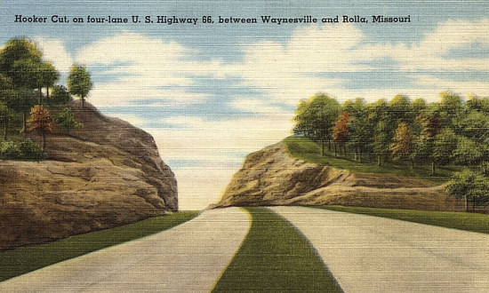 |
Highway 66 Crossing Big Piney River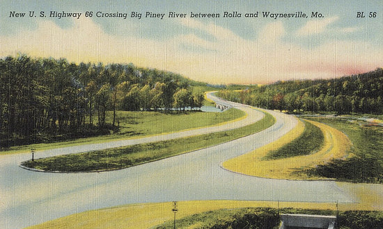 |
Route 66 Alignments and By-Pass in Rolla
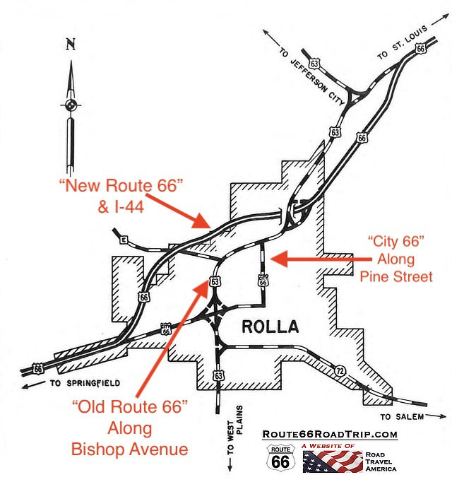
The original 1926 alignment of U.S. Highway 66 in downtown Rolla was on Pine Street, with two-way traffic flowing in both directions. As traffic levels increased over time, westbound traffic on Route 66 was moved to North Rolla Street, and Pine Street was changed to one-way traffic. This alignment is commonly called "City 66".
Pine Street, early years, two-way traffic 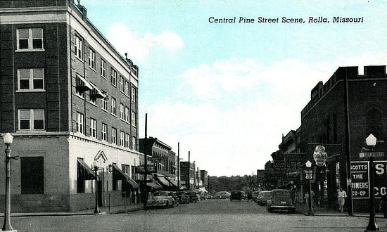 |
After Pine Street was switched to one-way traffic 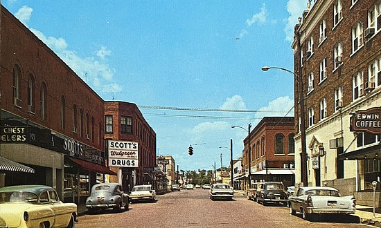 |
Highway service in Rolla was provided by U.S. Routes 63 and 66 and Missouri Route 72, together with a network of state supplementary highways and county roads.
U.S. Route 66 passed through the northern and western portions of the city. Rapidly increasing traffic on this route, the usual ribbon development of business along the highway, and its obsolete alignment and construction features created critical traffic and safety conditions. Studies were made of the various possibilities for relieving the condition, and new construction of a by-pass was deemed the best solution.
The by-pass around the central business district was thus built in the 1940s, along the Bishop Avenue corridor.
This new location by-passed the city to the north and west, touching the city limits for a short distance in the extreme north corner. The by-pass, also known today as the "Old Route U.S. 66," was shared with U.S. Route 63 for a major portion of the distance through the city.
Eventually I-44 replaced previous Route 66 alignments, overpaving some sections.
| Map of Route 66 Alignments in Rolla, Missouri (courtesy of Missouri DOT) |
 |
Scenes Around Rolla Today
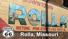
Downtown Rolla Mural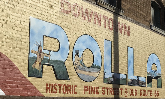 |
Fugitive Beach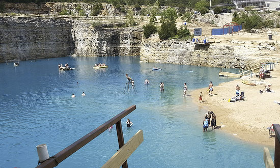 |
Havener Center 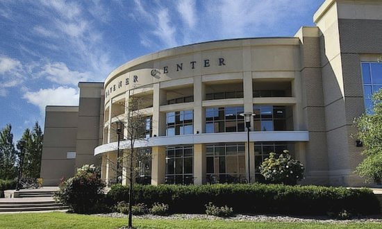 |
Stonehenge at Missouri S&T 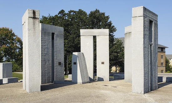 |
Frisco Steam Engine 1501 ... Schuman Park at 16th & Walnut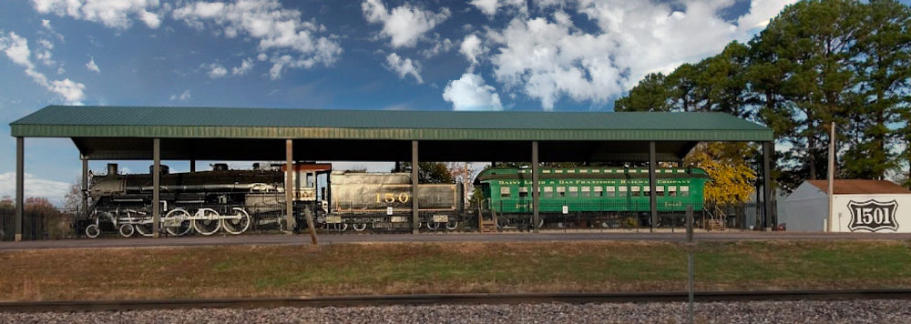 |
|
Mule Trading Post & Museum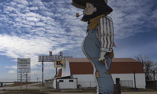 |
Lions Club Park 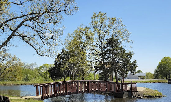 |
31st Annual Rolla Route 66 Summerfest
“Route 66” Summerfest will be held June 6th & June 7th in Rolla, Missouri. This is the 31st year for this event. It was originally started to promote Downtown Rolla but has evolved into an area wide celebration for all ages to promote Old Route 66 and the beginning of summer. Friday night kicks off Summerfest with a cruise down Route 66 from St. James to Rolla. The activities begin in the festival lot in Downtown Rolla with the Crazy Funny Dog Show, Drummers Competition and Movie Under the Stars. There will be music in the food court from 4:30 pm until 8 pm, food and craft vendors will be open most of the evening. There will be lots of children’s games and activities all evening as well. Saturday starts bright and early at 8 am with the Car Show lining up on Pine Street in Downtown Rolla. Hosting over 150 cars, spanning from Louisiana, Texas, Oklahoma, Arkansas and more, this is a great show that is growing each year. The Arts & Crafts booths open at 9am along with the food vendors, kids activities, the famous “burnout contest” at 6pm and the street dance at 7:30pm. There are many other events all throughout the day. More Info: Website |
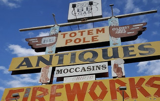
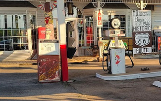
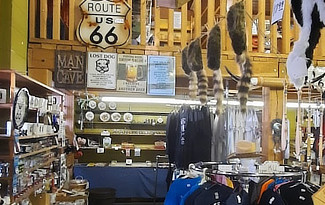
Totem Pole Trading Post in Rolla ... Missouri's Oldest Business on Historic Route 66 Open since 1933, Totem Pole Trading Post doors closing September 30, 2024 |
||
 |
 |
 |
Lodging & Travel Options in Rolla, Missouri
|
Hotels in Rolla with Traveler Reviews Rolla Restaurant Listings & Reviews Attractions & Things to Do in Rolla |
Interactive Map of Rolla, Missouri
Best-Selling Route 66 Books and Maps at our Amazon Store |
|
| Route 66 Travel Guide - 202 Amazing Places by Mark Watson  |
Route 66 Full-throttle Adventure Handbook, by Drew Knowles  |
| EZ66 Guide for Travelers (5th Edition) by Jerry McClanahan  |
Rand McNally 2026 Road Atlas Large Scale Spiral Bound  |
About These ProductsThe Route 66 Road Trip website is a participant in the Amazon Services LLC Associates Program, an affiliate advertising program designed to provide a means for sites to earn fees by advertising and linking to Amazon.com and affiliated sites. Amazon offers a commission on products sold through their affiliate links. There is no additional cost to you. |
|
Earlier Times in Rolla
We have included below a sampling of our collection of vintage travel postcards dealing with Rolla and Route 66.
What was Route 66 like in its earlier years, as visitors drove around Rolla? What did all the service stations, motels and public buildings look like when they were new? What did the traveling public experience on the Mother Road? We wonder such things when we travel Route 66 today.
Those earlier times in the 1930s, 40s and 50s were not always captured on film. But the use of colorful postcards was common in those decades.
These portray the historic road in its prime and help us to visualize, and appreciate, "earlier times" as we drive Route 66 today in Rolla.
Bypass Motel & Cafe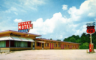 |
Hotel Edwin Long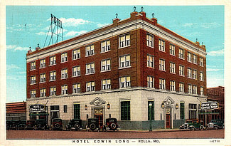 |
Rolla Rancho Motel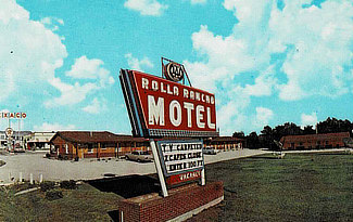 |
Carney Manor Inn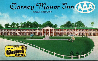 |
The Mule Trading Post |
Pennant Hotel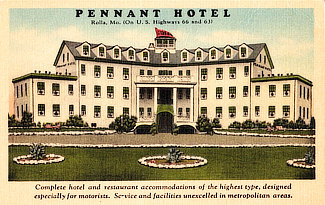 |
Hull's Colonial Village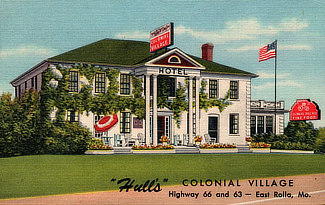 |
Toky's Bar-B-Q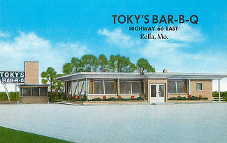 |
Schuman's Tourist City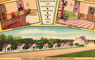 |
More Information & Resources about Rolla |
|
|
||||||||||||
