Route 66 Road Trip Guide for Oklahoma
 |
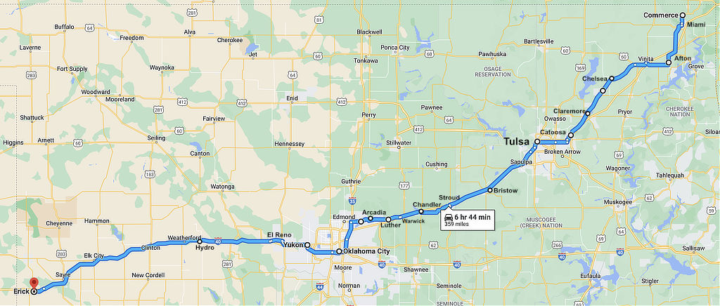
As Route 66 left Joplin, Missouri westbound, it was only a short distance to Kansas, and then to the Oklahoma border.
It quickly entered Quapaw, and headed southwest through Commerce, Miami, Afton, Chelsea, Claremore and Tulsa. The road continued through Stroud, Chandler and Arcadia to Oklahoma City.
From there, it was a straight shot west through Yukon, El Reno, Hydro, Clinton and Elk City, and finally Texola.
The Mother Road crossed the Texas state line at Texola, near Shamrock, and moved on to Amarillo.
The nation's longest drivable stretch of Route 66 crosses Oklahoma, making its way past charming towns, roadside diners and quirky attractions.
Vintage postcard showing
the location of Route 66 across Oklahoma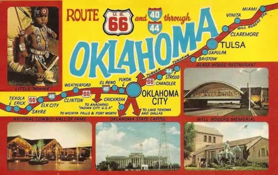 |
|
Map of approximate Historic Route 66 across Oklahoma
Highlights of the many things to see on Oklahoma Route 66
 |
There are dozens of places to see and visit along Route 66 across Oklahoma.
Experience Miami, Oklahoma City, Tulsa and authentic hometowns along the Mother Road where you'll meet friendly people and find unique shopping and dining opportunities.
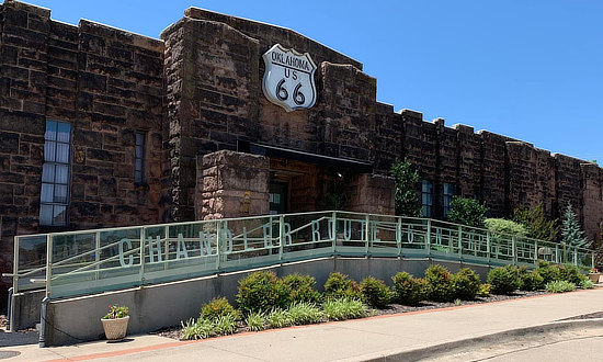
Several state-of-the-art museums pay tribute to America's Main Street including the Oklahoma Route 66 Museum in Clinton, the National Transportation and Route 66 Museum in Elk City and the Route 66 Interpretive Center in Chandler. And while in Oklahoma City, we recommend a visit to the Oklahoma City National Memorial & Museum downtown ... it is a sobering experience.
Along the way you will still find quaint service stations, diners, motels and other structures dating from those earlier times on Route 66.
Now let's head west on The Mother Road, where we will make stops at these 26 locations on Route 66 in Oklahoma, starting at Quapaw and ending at Erick near Texas:
| Quapaw | Warwick |
| Commerce | Luther |
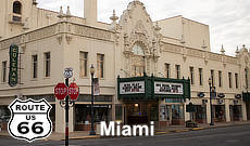
| Miami | Arcadia |
| Afton | Edmond |
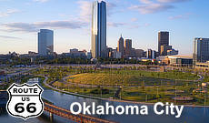
| Vinita | Oklahoma City |
| Chelsea | Yukon |
| Claremore | El Reno |
| Catoosa | Hydro |
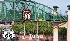
| Tulsa | Weatherford |
| Sapulpa | Clinton |
| Stroud | Elk City |
| Davenport | Erick |
| Chandler | Texola |
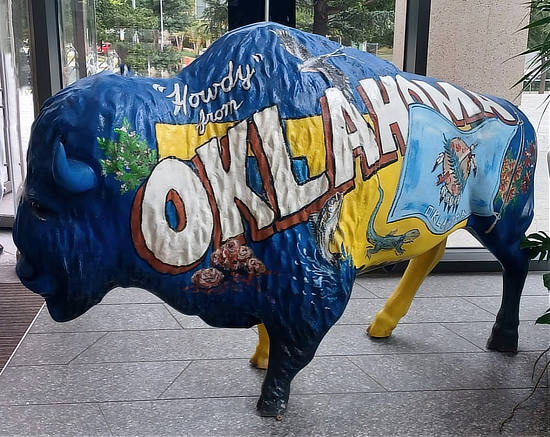
Howdy from Oklahoma!!
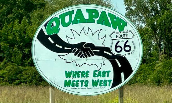
Quapaw, Oklahoma on Route 66 ... Where East Meets West
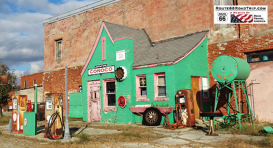
Commerce, OklahomaAllen's Conoco Fillin' Station |
Regular gasoline pump at Allen's Conoco Fillin' Station, Commerce, Oklahoma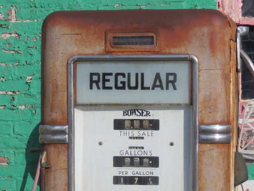 |
| Mickey Mantle Home and Statue in Commerce | |
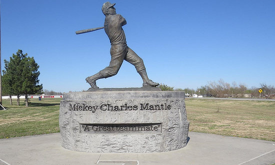 |
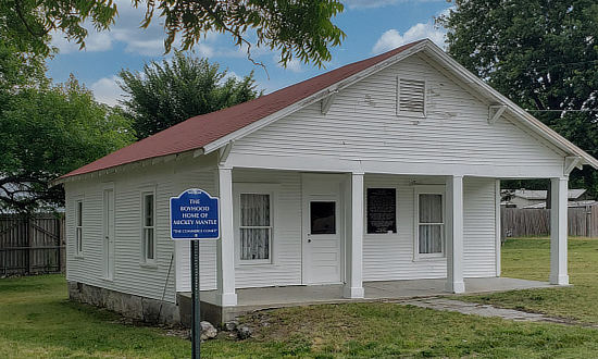 |
Dairy King, Commerce, Oklahoma ... a former circa mid-1920s Marathon Service Station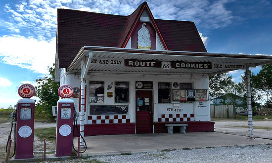 |
|
Miami, Oklahoma |
|
The Gateway to Route 66 in Miami, OK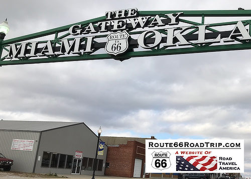 |
Historic Marker about the Gateway Sign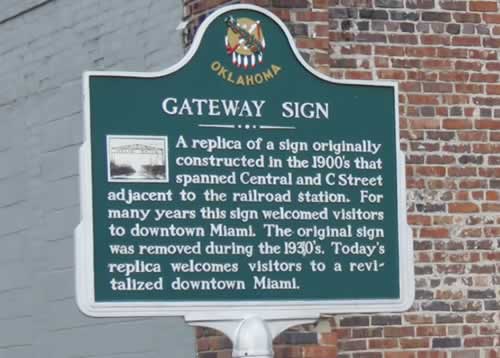 |
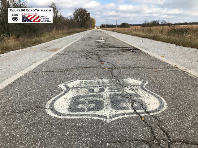
Ribbon Road Near MiamiSection of Old Route 66 9-foot wide "Ribbon Road" or "Sidewalk Highway" still visible near Miami, Oklahoma, seen here in this staff photo taken in November, 2018.
|
Lodging Options Along Route 66 in Eastern Oklahoma
Miami has more than 500 hotel rooms located conveniently off Interstate 44 and Route 66.
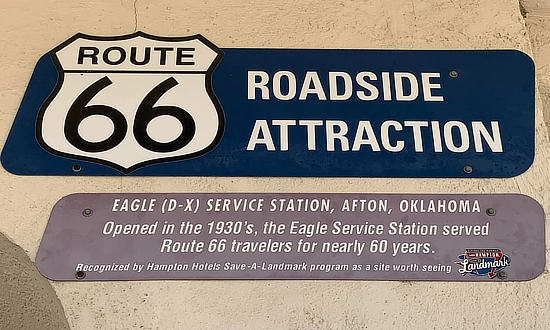
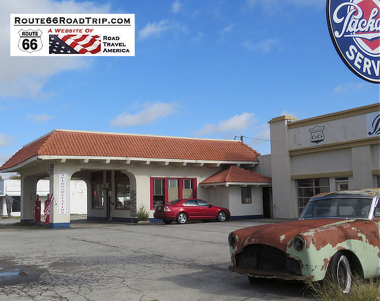
Afton, OklahomaEagle DX Service Station in Afton, opened in the 1930s on Route 66 |
|
|
 |
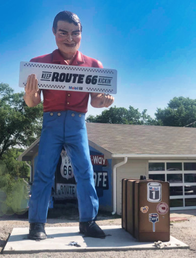
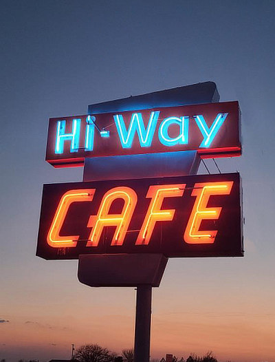
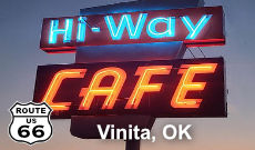
"Big Bill" and the Hi-Way Cafe in VinitaThe newest "Muffler Man" on Route 66 was installed at the family-owned Hi-Way Cafe in Vinita, Oklahoma, in June of 2023. He towers about 24 feet in height; at his feet is a large suitcase. It was announced in July of 2025 that the "Chef Muffler Man" in Springfield, Missouri is being moved to the Hi-Way Cafe. Big Bill and his cool suitcase will be heading next door to the Western Motel, making room for a brand-new face at the Hi-Way Cafe, a Chef giant, Big Al, who's ready to serve up smiles and roadside nostalgia. Alan and Beth Hilburn own and operate the cafe. "Big Bill" is named after the late Bill Wood, Beth's father. It was announced in July of 2025 that the "Chef Muffler Man" in Springfield, Missouri is being moved to the Hi-Way Cafe. Big Bill and his cool suitcase will be heading next door to the Western Motel, making room for a brand-new face at the Hi-Way Cafe, a Chef giant, Big Al, who's ready to serve up smiles and roadside nostalgia. In March of 2023, thanks in part to grants from the National Park Service's Route 66 Corridor Preservation Program and the National Trust for Historic Preservation’s Backing Historic Small Restaurants Grant Program, the Hi-Way Cafe was able to relight its restored iconic neon sign. The Cafe is located at 437918 E Highway 60, about two miles west of Vinita. Learn more at the Hi-Way Cafe website and the Hi-Way Cafe on Facebook. Phone 918.256.5465 |
|
 |
 |
Best-Selling Route 66 Books and Maps at our Amazon Store |
|
| Route 66 Travel Guide - 202 Amazing Places by Mark Watson 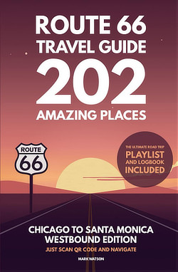 |
Route 66 Full-throttle Adventure Handbook, by Drew Knowles 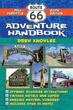 |
| EZ66 Guide for Travelers (5th Edition) by Jerry McClanahan 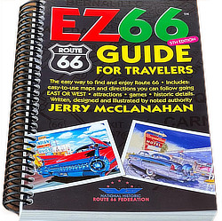 |
Rand McNally 2026 Road Atlas Large Scale Spiral Bound  |
About These ProductsThe Route 66 Road Trip website is a participant in the Amazon Services LLC Associates Program, an affiliate advertising program designed to provide a means for sites to earn fees by advertising and linking to Amazon.com and affiliated sites. Amazon offers a commission on products sold through their affiliate links. There is no additional cost to you. |
|
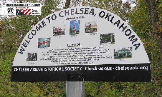
Welcome to Chelsea, Oklahoma Welcome to Chelsea, Oklahoma ... Established 1889 |
||
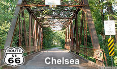
Pryor Creek BridgeThe historic Pryor Creek Bridge was built in 1926 and carried U.S. Highway 66 traffic from then to 1932, when a new alignment bypassed the bridge. It is of "Modified Pratt Through Truss" design,123 feet long and 19 feet wide. Located near Chelsea, it was added to the National Register of Historic Places in 2006. |
||
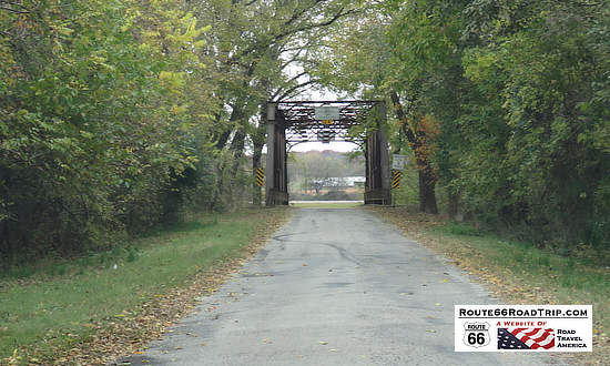 |
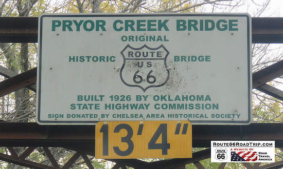 |
|
Chelsea Route 66 Pedestrian UnderpassThe tunnel dates to a time when four-lane Route 66 was so busy that locals built a tunnel so pedestrians could cross under the highway safely. Today, it can still be walked through, at Walnut Street and West 6th Street in Chelsea. Get your kicks UNDER Route 66! |
||
Chelsea Route 66 Underpass - entrance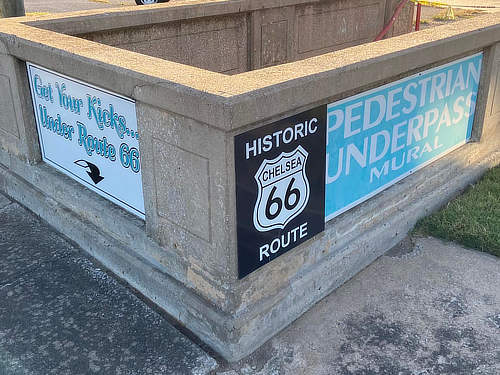 |
Route 66 Underpass Mural - interior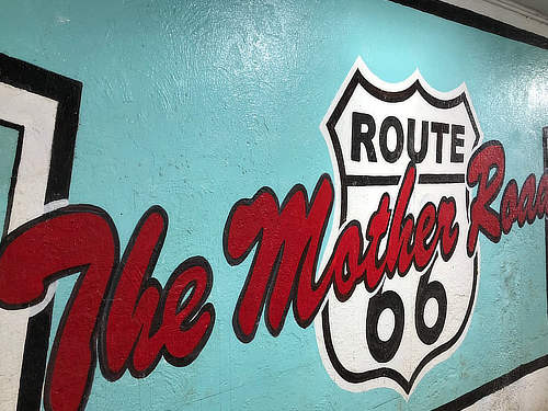 |
|
Chelsea MotelThe Chelsea Motel is located at the intersection of Historic Route 66 (N. Walnut Street) and E. First Street in Chelsea. It dates to circa 1936, and was alerted to Route 66 travelers by its large, elaborate neon sign that has survived into modern times. The simple stucco rectangular building consisted of six motel units; behind the motel was a smaller building that served as the motel office and home of the owner. Today, the motel is privately owned and used for storage. It is not accessible to the public but can be viewed from the public right of way. It was added to the National Register of Historic Places in 2004. |
||
Seen below is a staff photo of the old
Chelsea Motel taken in November of 2018.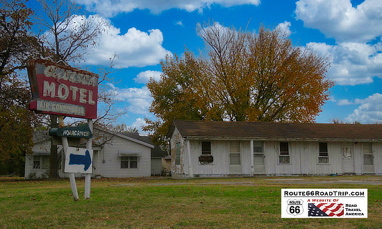 |
|
|
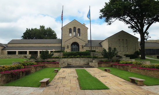
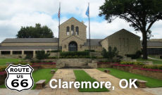
ClaremoreLocated on Route 66 between Chelsea and Catoosa, is the city of Claremore, home to about 20,000 residents. Among the attractions are the Will Rogers Memorial Museum (photo below), the J.M. Davis Arms & Historical Museum, the Belvidere Mansion, and Lake Claremore. For more information about the city, its history and attractions, link to the VisitClaremore.org website
|
Catoosa, Oklahoma
|
||
 Click to read more about Route 66 in Catoosa |
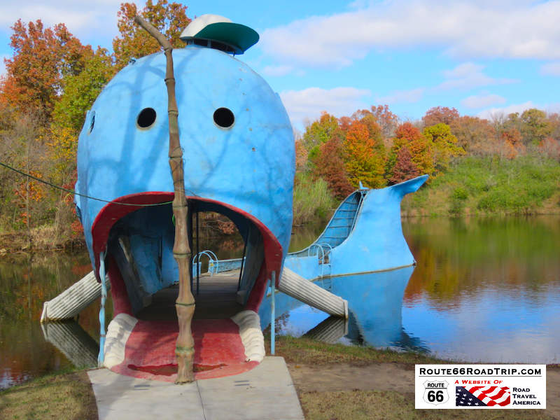
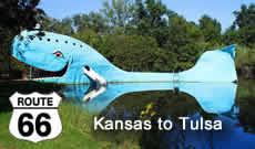
Today, travelers can walk through the whale, and shop at a nostalgic gift shop on site. Free admission and parking.
Located northeast of Tulsa in Catoosa, OK
The D.W. Correll Museum
This main building of the museum in Catoosa contains a rare collection of rocks, gems, fossils and minerals from around the world.
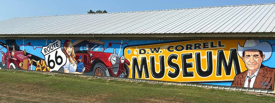
The second building houses antique automobiles restored by Mr. Correll, and other items of broad curiosity and antiquity such as the historical Texaco gas pump. There is also a collection of antique toy tractors, cars, pickups, etc. on display. The main building has a beautiful, painted mural on the outside (see photo below) done by the award-winning artist Lance Hunter that honors the late D.W. Correll, the museum's benefactor and a beloved Catoosa resident. The brightly colored, attention-getting mural, is 8 feet tall and 72 feet wide.
read more about the Correll Museum in Catoosa
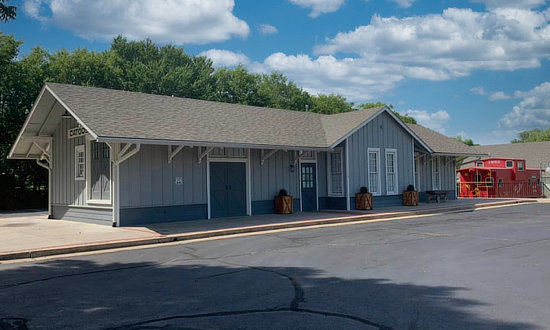
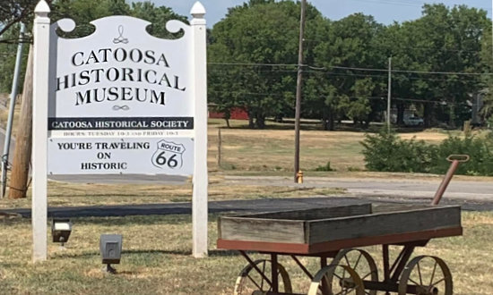
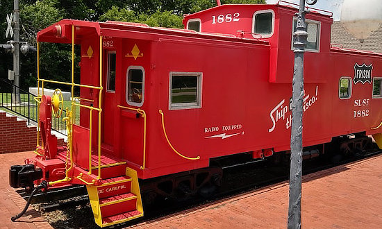
Catoosa's Historical Society MuseumCatoosa's Historical Museum was founded by Catoosa's Historical Society. The train depot and railroad have played an important part in Catoosa's history, and it's only appropriate that the Catoosa Historical Society Museum is housed in the old depot. Visitors will find numerous local history displays including vintage photographs of Catoosa's early residents, a mailbox that was used when mail was delivered on horseback, a train depot log book dating from 1897 and a check from the Farmers and Merchants Bank dated 1907. The Catoosa Historical Museum is easily recognized by the bright red caboose outside of the museum. It is located at 207 South Cherokee Street in Catoosa. Hours are typically 10:00am - 3:00pm on Tuesday and Friday. Phone 918.266.3296 for current opening days and hours.
|
|
 |
 |
The Sculptures in Tulsa
|
||
Developer pulls out of Tulsa Cry Baby Hill project, statue almost completed Hotel at Cry Baby Hill to highlight Route 66 |
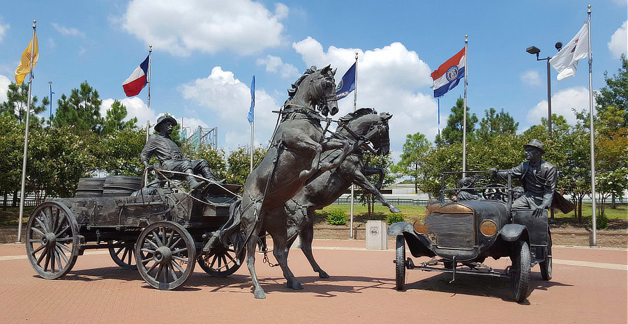
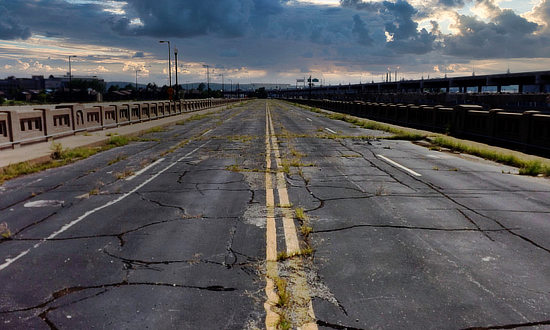
Route 66 Bridge Over the Arkansas River
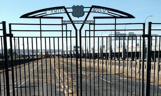
Directly west of Cyrus Avery Centennial Plaza is the original Eleventh Street Bridge bridge built in 1915 to carry Route 66 over the Arkansas River. It is located between newer bridges on Southwest Boulevard and Interstate 244, and was closed to traffic in 1980 although it remained open for pedestrians for a time.
Gates were locked on the bridge in 2008, and it remains closed to both vehicular and pedestrian traffic today. The old bridge is listed on the National Register of Historic Places and re-named the Cyrus Avery Route 66 Memorial Bridge.
The Golden Driller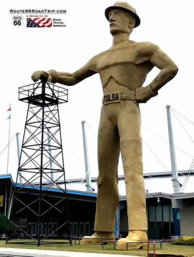
Located at 4145 E. 21st Street in Tulsa. |
The Golden Driller is a 76-foot, 22-ton statue of an oil worker in Tulsa, located outside the Tulsa Expo Center. It is the 6th tallest statue in the United States. The plaque at the base reads "The Golden Driller, a symbol of the International Petroleum Exposition. Dedicated to the men of the petroleum industry who by their vision and daring have created from God’s abundance a better life for mankind."
|
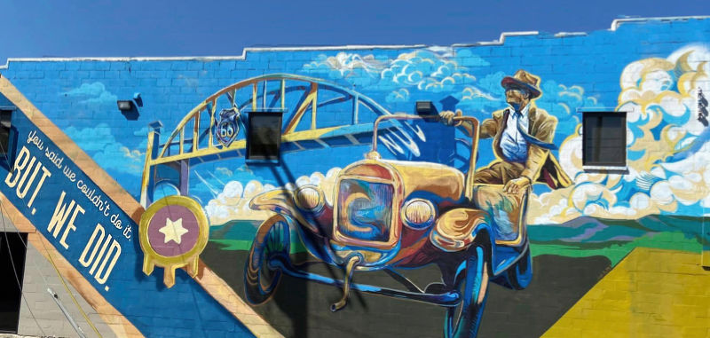
"You Said We Couldn't Do It" MuralThis mural commemorates a bridge built over the Arkansas River in Tulsa in 1904. The bridge wasn’t for rail traffic, so investors considered it a risky project. The government wouldn’t pay for it either. Instead, three citizens formed a toll company and paid for the bridge, a huge undertaking both financially and logistically due to the shifting river bed. On the completed bridge they hung a sign, “You Said We Couldn’t Do It, But We Did.” Located in the Meadow Gold District - 1306 E. 11th Street at S. Peoria Avenue
|
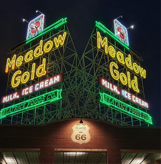
The Meadow Gold Neon SignAs the largest neon sign on Tulsa's landscape, the Meadow Gold sign is unique. With each face measuring 30 feet by 30 feet, the size and design of the Meadow Gold sign set it apart from all of the other signs that have been preserved and restored along historic Route 66. Erected in 1934, the Meadow Gold sign stood above its rooftop perch at 11th Street (Historic Route 66) and South Lewis Avenue for nearly seven decades and served as a reminder of days gone by - days of the milkman and deliveries of dairy products to the porches and front doors of Tulsa, and America. In August of 2004, the Tulsa Foundation for Architecture (TFA) applied for and received a grant from the Route 66 Corridor Preservation Program administered through the National Park Service to restore the Meadow Gold sign at its original location. Located in the Meadow Gold District - 1324 E. 11th Street |
||
 |
|
|
Buck Atom’s Cosmic Curios |
|
Buck Atom |
Stella Atom |
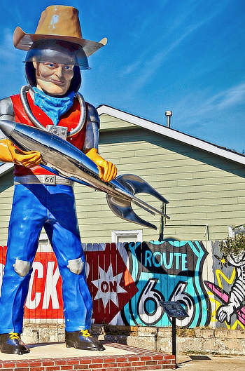
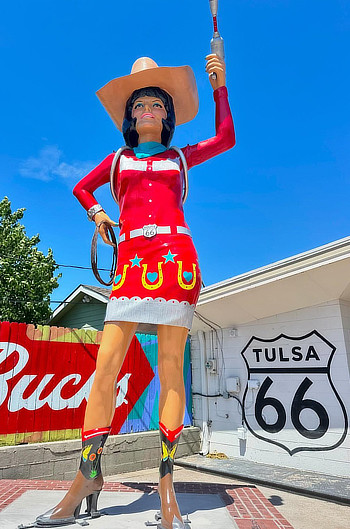
Located in a former site of a 1950s PEMCO gas station, Buck Atom’s Cosmic Curios on 66 welcomes visitors from all over to celebrate the magic of the Mother Road with apparel, toys, souvenirs, home accessories, art, jewelry and more. Stop by this unique retailer for a fun photo op with the 21-foot-tall Muffler Man, Buck Atom, space cowboy. On June 28, 2024, he was joined by Stella Atom, space cowgirl! These bigger than life figures are located at 1347 E. 11th Street in Tulsa. |
|
Lodging and Dining Options in Tulsa
|
Hotel listings and traveler reviews for Tulsa Restaurant reviews for Tulsa |
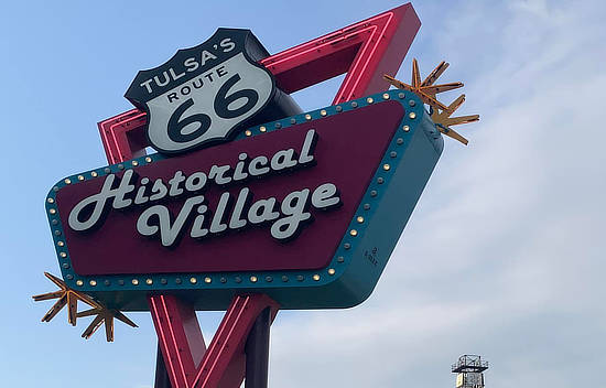
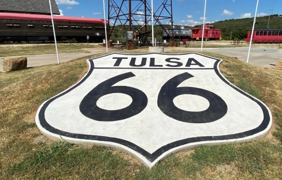
Route 66 Historical VillageThis open-air museum is a unique experience to educate visitors about Tulsa's history in the oil, refining and transportation industries. The Visitor’s Center is a replica of a 1920’s Phillips 66 gas station. The tallest oil derrick in North America is a favorite with visitors. Located at 3770 Southwest Boulevard. |
|
 |
 |
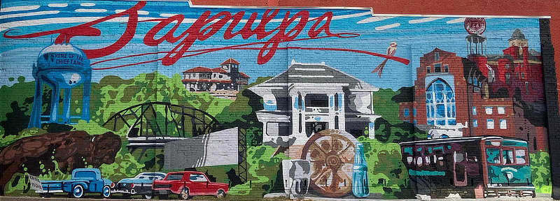
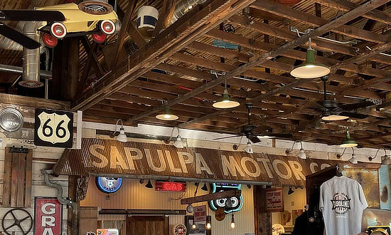
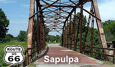
Sapulpa, OklahomaSapulpa is the county seat for Creek County and is located in northeast Oklahoma’s Green Country, about 14 miles southwest of downtown Tulsa. The city is located on old U.S. Route 66, now SH-66 and Historic Route 66 (a/k/a the West Ozark Trail), through town. For more information, visit ... City of Sapulpa website
|
||||
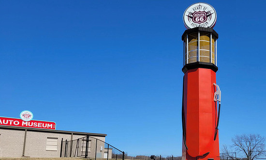
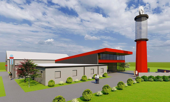
Heart of Route 66 Auto MuseumThe Museum in Sapulpa features the world's tallest gas pump, at 66-foot-tall, a prominent Route 66 landmark. It also includes an extensive indoor collection of historic automobiles and other historical treasures. The Museum is on the grow, with an all new expansion planned for 2023. See photo below right, courtesy of Reed Architects, the designers of the new expansion. This will be a 60% expansion to boost its visibility, exhibit space, and revenue streams. The project includes 5,000 square feet under roof and a 2,400-square-foot outdoor plaza. It promises a dramatic increase in the museum’s 36-vehicle inventory and other exhibits. This expansion parallels a neighboring park development by the city of Sapulpa. The Route 66 Rock Creek Park will provide a tourist-friendly playground and rest stop connected to the museum. The Museum is located at 13 Sahoma Lake Road, Sapulpa, OK 74066. For more information, phone 918.216.1171, or visit .... The Heart of Route 66 Auto Museum website and The Heart of Route 66 Auto Museum on Facebook |
|
 |
 |
 |
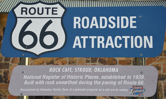 |
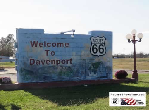
Davenport, OklahomaWelcome to Davenport, Oklahoma, on Historic Route 66 |
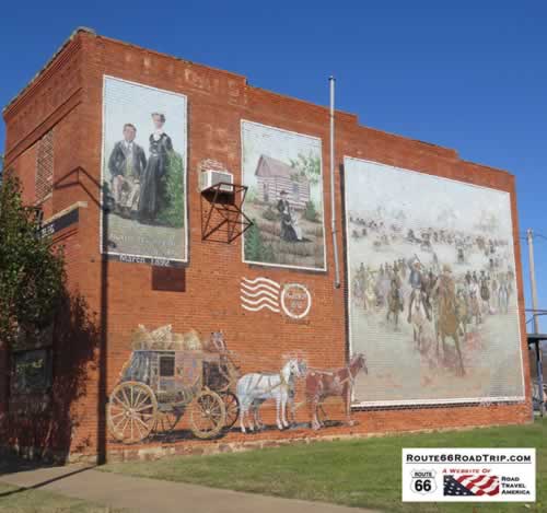
One of the many classic murals in Davenport, Oklahoma, on Historic Route 66 |
 |
Route 66 Cap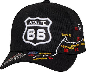  |
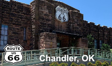
Chandler, OklahomaRoute 66 Interpretive Center at 400 E 1st Street in Chandler |
Phillips 66 Service Station, Chandler, Oklahoma, on Historic Route 66 |
McJerry's Route 66 Gallery in ChandlerWhile in Chandler, be sure to stop and visit McJerry's Route 66 Gallery at 306 Manvel (Highway 18), just off OK 66, north of downtown. The Gallery is operated by Jerry McClanahan, the award-winning artist and Route 66 historian/writer of the popular EZ 66 Guide for Travelers. Phone 405.240.7659 for more information and opening times, and visit the McJerry66.com website. |
|
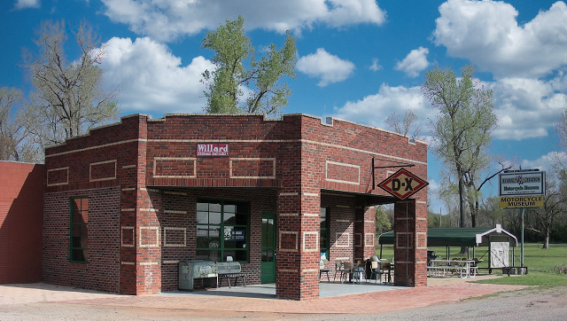
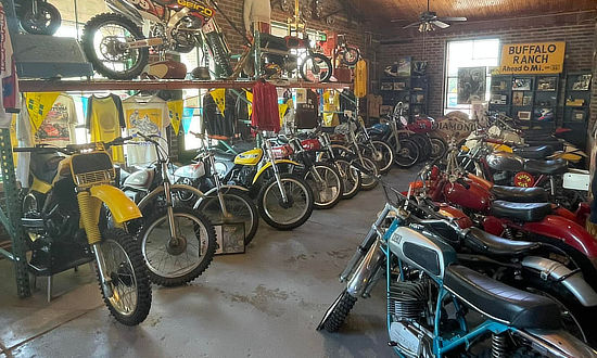
Seaba Station Motorcycle MuseumThe Seaba Station Motorcycle Museum is located at 336992 E. Highway 66 in Warwick, Oklahoma, west of Chandler. Seaba Station was built in 1921 by John and Alice Seaba, five years before historic Route 66 would be certified. This building's life started out as a DX station, and has now been restored and operated as a popular motorcycle museum. Seaba Station Motorcycle Museum website and Seaba Station on Facebook |
|
 |
 |
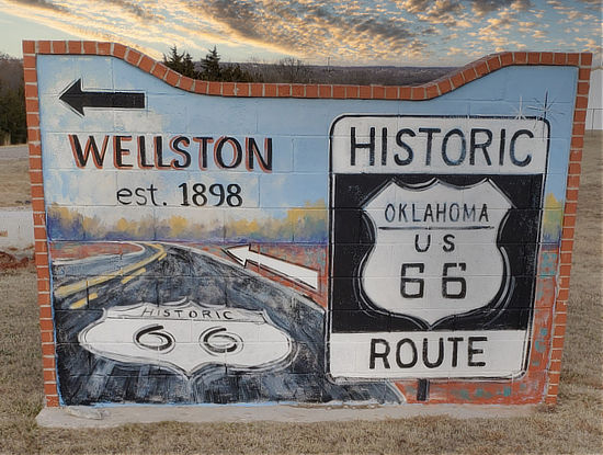
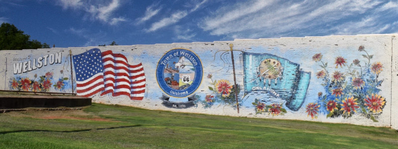
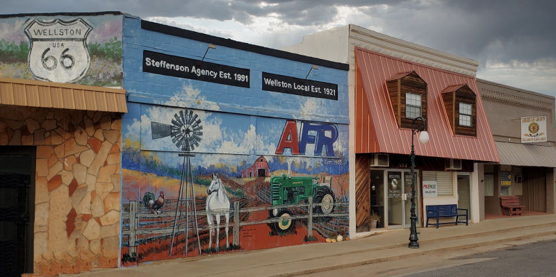
Wellston, OklahomaLocated between Warwick and Luther in Lincoln County on Route 66 is the town of Wellston, established in 1898. In 1932 State Highway 66 was constructed one mile south of Wellston, threatening the town's survival. After a dispute with the state highway department, "Wellston Gap" (a bypass) was paved through town.
Shown below is a lovely mural at the corner of Birch Street and 2nd Street (Highway 66B) in Wellston. Downtown scene in Wellston, Oklahoma |
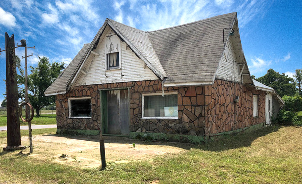
Threatt Filling Station and Family FarmThe historic Threatt Filling Station is located near the intersection of Route 66 and Pottawatomie Road, about 3 miles east of Luther, Oklahoma. The station offered African Americans a place to purchase food and fuel, as well as an opportunity for a respite from their travels during times when segregation was still in place. It offered a variety of services, including gas, oil, automotive accessories, groceries, cold beer and oil changes. The station building and a nearby bar were built by Allen Threatt Sr. on about 150 acres of property he purchased in 1915, land that the Threatt family still owns. The filling station was closed in the 1970s. The National Trust for Historic Preservation has included the Threatt Filling Station and Threatt Family Farm on its list of the 11-Most Endangered Places in America, and is listed on the National Register of Historic Places. Today, in 2023, the station is being restored.
For more information about the history of the station and the family, visit the Threatt Filling Station Foundation website and Threatt Filling Station on Facebook. Also, learn more about the Threatt Filling Station at the National Park Service (NPS) website More information about restoration efforts and progress Historic preservationists lead restoration project of Threatt Filling Station in Luther |
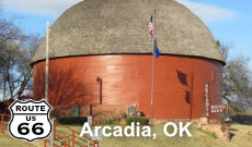
Arcadia, OklahomaJust east of Oklahoma City ... Home of the Round Barn |
Built in April of 1898 by William Odor on his farm. Restored in 1992. 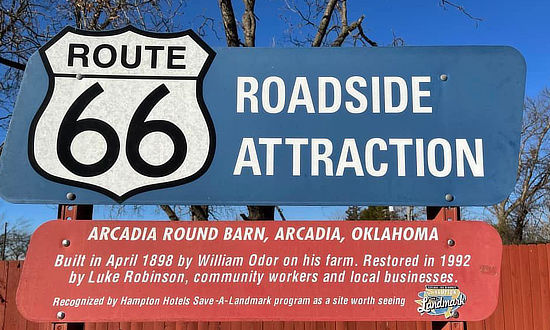 |
The Historic Richardson Building, since 1923, in Arcadia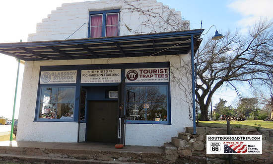 |
The Arcadia Round Barn, on Historic Route 66 in Arcadia 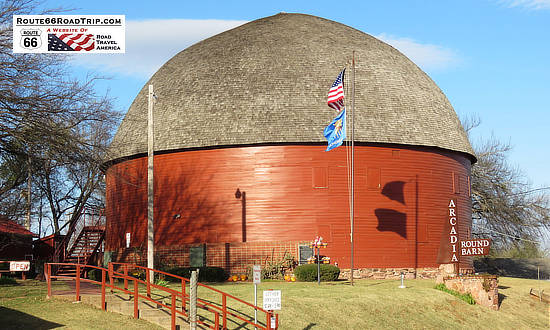 |
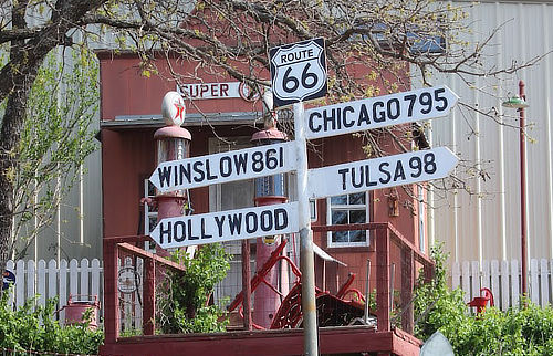
John's PlaceWhile in Arcadia, you don't want to miss John Hargrove's OK County 66 Place at 12441 E. Highway 66. It has soooo much Route 66 memorabilia, artifacts, cars, bikes, signs, antiques, and miniature models of many Mother Road attractions. He even has a replica of the Catoosa Blue Whale on his pond! |
|
 |
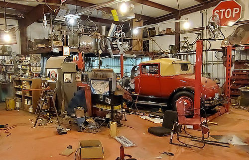 |
Edmond, Oklahoma ... The Mural, and Much MoreEdmond is home to championship golf courses, indoor/outdoor food halls, downtown street festivals and local shopping galore. Cruise Route 66 to camp at Arcadia Lake, tour historic sites and snap selfies. Explore acres of parks, 270 public art pieces and 250 restaurants, then relax in your choice of 15 hotels and more than 50 vacation homes. |
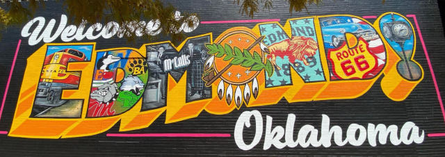 |
Popular Sights and Things to See in Oklahoma City
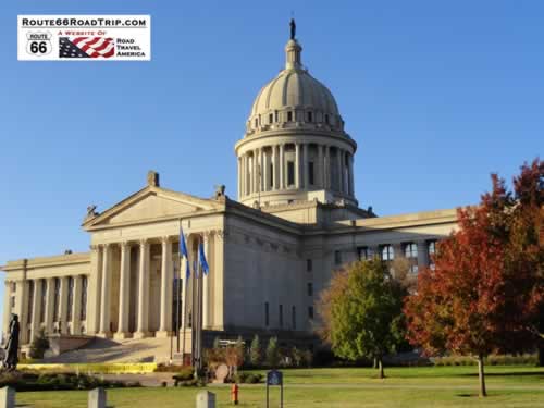
Oklahoma State CapitolKnown as the only state capitol complex to have working oil wells on-site. The Oklahoma capitol's dome features The Guardian, a three-ton, 17 ½ foot tall bronze American Indian statue that depicts characteristics from all 39 native tribes of Oklahoma. The building also features stained glass, murals and art exhibits that you can see on a guided tour. Located at 2300 N. Lincoln Boulevard
|
||||
Lodging and Dining Options in Oklahoma City
|
||||
National Cowboy & Western Heritage MuseumThis world class museum is located at 1700 Northeast 63rd Street in Oklahoma City. For more information visit the website of the National Cowboy Museum
|
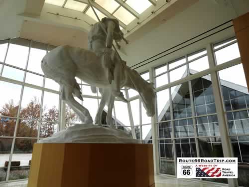
|
|||
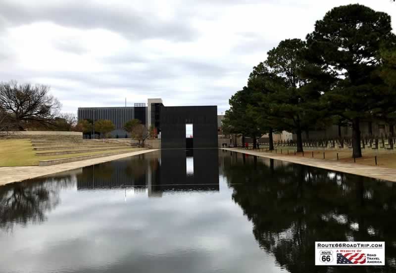
The Oklahoma City National Memorial & Museum, downtown, on a cold somber day in the fall of 2018
For more information visit the website of the Oklahoma City Memorial
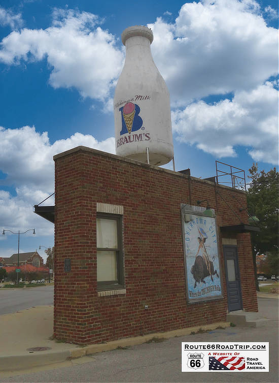
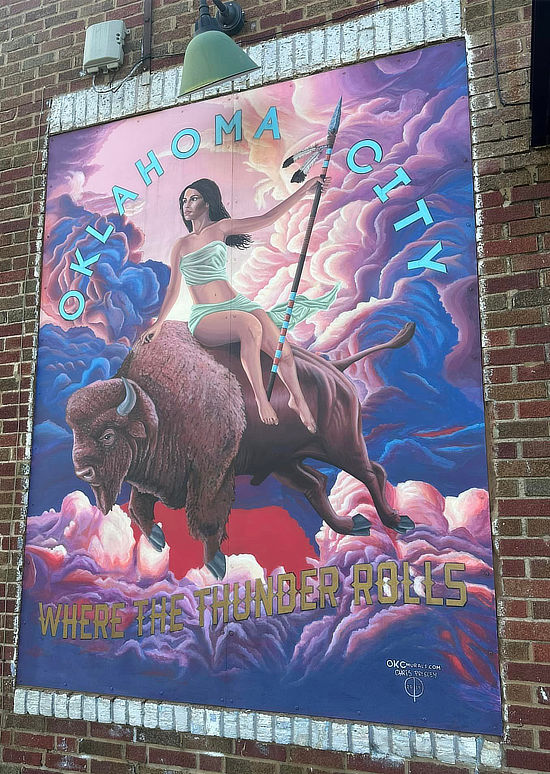
Milk Bottle GroceryThe Milk Bottle Grocery is located on a small triangular piece of property at 2426 N. Classen Avenue in Oklahoma City along Historic Route 66. The grocery was built in 1930, and the giant milk bottle was added in 1948. It is listed on the National Register of Historic Places. Today, it is adorned with a milk bottle from Braum's, the well-known Oklahoma-based dairy in Tuttle. On one side of the grocery is the "Oklahoma City ... Where the Thunder Rolls" mural. |
|
 |
 |
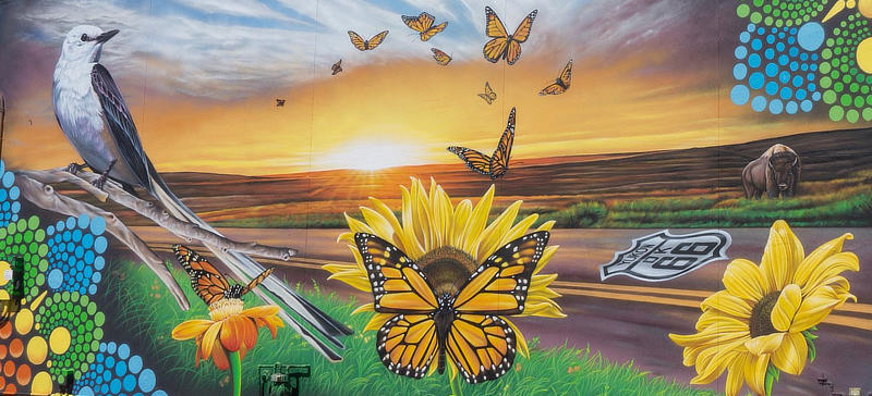
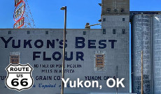
Yukon, Oklahoma ... The Route 66 Murals, and MoreYukon is full of rich history, Route 66 roots, music heritage, family-friendly attractions, and beautiful art. Explore a while, and see why folks flock from all over to pay the city a visit! |
 |
 |
Popular Route 66 Books and Maps at our Amazon Store |
|
| Route 66 Travel Guide - 202 Amazing Places by Mark Watson  |
Route 66 Full-throttle Adventure Handbook, by Drew Knowles  |
| EZ66 Guide for Travelers (5th Edition) by Jerry McClanahan  |
Rand McNally 2026 Road Atlas Large Scale Spiral Bound  |
About These ProductsThe Route 66 Road Trip website is a participant in the Amazon Services LLC Associates Program, an affiliate advertising program designed to provide a means for sites to earn fees by advertising and linking to Amazon.com and affiliated sites. Amazon offers a commission on products sold through their affiliate links. There is no additional cost to you. |
|
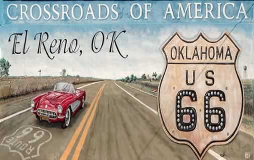
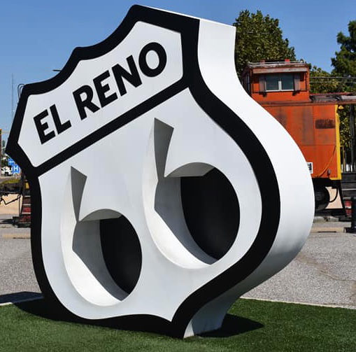
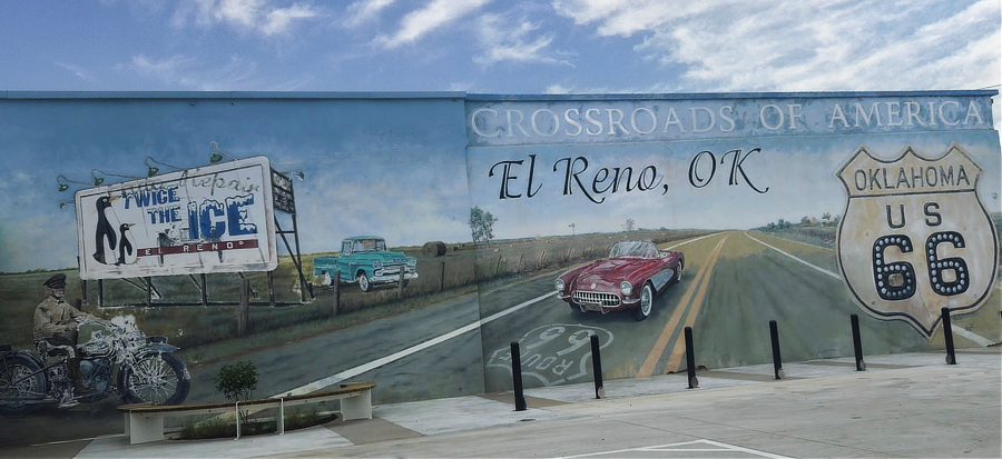
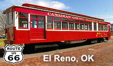
El Reno, Oklahoma ... The Crossroads of AmericaEl Reno was established in 1889 and is located at the intersection of two historic highways: nostalgic Route 66 and the Chisholm Trail (Hwy. 81). The city began as a railroad town and was home to three Land Runs. Today, it is a festival town and boasts many heritage celebrations, historic properties, and the only rail based trolley operating in the state of Oklahoma. |
|
Lodging, Dining and Attractions in the El Reno Area
Hotels in/near El Reno with traveler reviews at TripAdvisor El Reno restaurant reviews at TripAdvisor Attractions and Things to Do in El Reno |
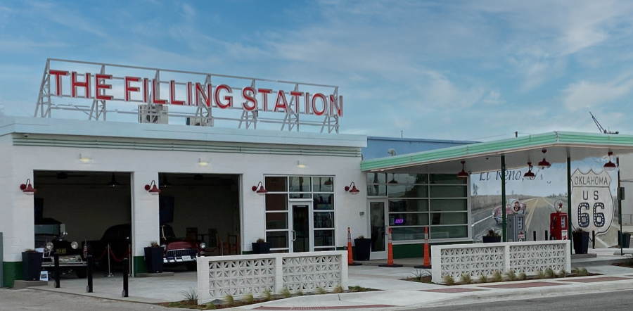
The Filling Station in El RenoThe Filling Station Visitor Center is located at 120 South Choctaw Avenue, at the corner of Route 66 and U.S. Highway 81, Downtown El Reno. Highway 81 is also known as the "Pan American Highway" and the "Chisholm Trail". The station is a restored circa-1930s Texaco station, and offers clean restrooms, cold drinks, El Reno souvenirs for travelers, and rotating displays of vintage automobiles. Opened in May of 2025. Across the intersection is Petree Plaza, with more Route 66 photo ops and an historic Rock Island Railroad caboose. For more information, visit The Filling Station on Facebook
|
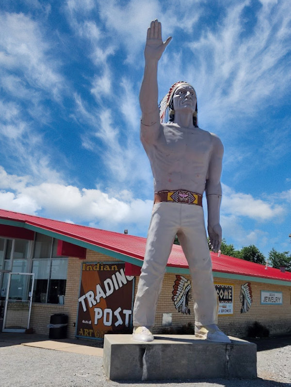
The Giant Native American in Calumet, OklahomaThis giant Native American statue is located at the Indian Trading Post and Art Gallery at 825 South Walbaum Road in Calumet, Oklahoma. It was previously located at the David Howe Auto dealership off Route 66 until 2010. The Trading Post features Native American themed apparel, hand-beaded jewelry, and other memorabilia. This nostalgic store also carries Native American art from a large number of nearby tribes including pottery, paintings and other great pieces. Phone the Trading Post at 405.884.5599 for more information, and about opening times.
|
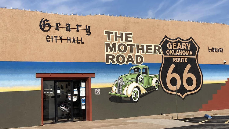
Geary, OklahomaLocated between El Reno and Bridgeport is the City of Geary, partially in Blaine County and Canadian County. The area occupied by the present city was previously part of the Cheyenne-Arapaho reservation until it was opened in April, 1892 for settlement by non-Indians. The Geary post office was established October 12, 1892. Geary was located on the old Postal Highway, which later became part of Route 66 in 1926. In 1933, a new Pony Bridge was built across the Canadian River downriver from Bridgeport. Route 66 was realigned directly from El Reno to Hydro, bypassing Calumet, Geary, and Bridgeport the following year. Today, the city is located on U.S. Highways 270 and 281. Shown below is a lovely "Route 66 Mother Road" mural on the Geary City Hall at the corner of Main Street and South Broadway. While in Geary, Route 66 visitors enjoy a visit to the Canadian Rivers Historical Museum in the old Gillespie Building, built in 1903 as the Bank of Commerce.
|
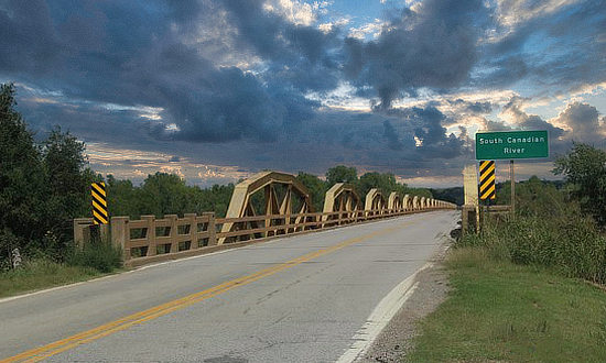
The Pony Bridge ... On Historic U.S. Route 66This well known bridge on Old Route 66 over the South Canadian River is located near Bridgeport, OK, between El Reno and Hydro. Built in 1934, it remains the longest truss bridge in Oklahoma and the entire Mother Road route. The 38-span pony truss bridge is 3,944 feet in length, and officially named the William H. Murray Bridge. Pony trusses are bridge trusses that don’t connect at the top. The bridge, on the National Register of Historic Places was closed beginning in 2022 for a two year reconstruction. The bridge was widened to current standards, and the trusses reinstalled along the sides to retain its historical value. It was reopened in May of 2024.
|
Hydro, OklahomaThe Town of Hydro is located between Bridgeport and Weatherford on Historic U.S. Route 66. Shown below is the beautiful "Welcome to Hydro and Route 66" mural on the side of The Station, at the corner of Arapahoe Avenue and Main Street. It makes a great photo op for Route 66 travelers! Read more at Welcome to Hydro Mural on Facebook
|
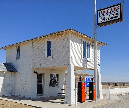
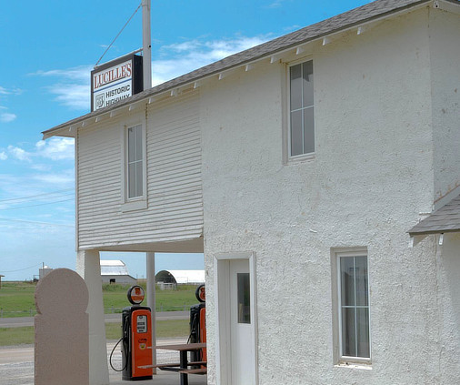
Lucille's Service Station and Roadhouse in HydroLucille's Service Station, a classic gas station built in 1929 along Route 66 near Hydro, is one of only two upper-story, out-thrust porch style stations left on Oklahoma's stretch of Route 66. In 1941, the Hamons family took over the operation of the station and Lucille Hamons, ran the business for 60 years. Lucille, who quickly became known for her friendly assistance to motorists, earned the nickname "Mother of the Mother Road." |
|
 |
 |
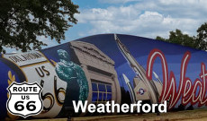
WeatherfordThe city of Weatherford was initially located on State Highway 3 starting in the early 1920s, which was redesignated as U.S. Route 66 in 1926 and paved entirely across Western Oklahoma by 1932. Route 66, which followed Main Street through the city, was lined with various tourist businesses including cafes, motels and gasoline stations like most other cities along the highway. Today, Weatherford is home to the Stafford Air & Space Museum, the Oklahoma Heartland Museum, the Weatherford Wind Energy Park, several city parks, golf courses and much more. More information about area attractions at the City of Weatherford's tourism website |
|
Centennial Park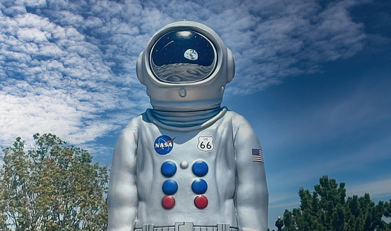 |
Stafford Air & Space Museum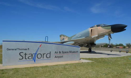 |
The windmill blade mural in Weatherford |
|
Lodging, Dining and Attractions in Weatherford
 |
|
Hotels in/near Weatherford with traveler reviews at TripAdvisor Weatherford restaurant listings & reviews at TripAdvisor Attractions and Things to Do in Weatherford |
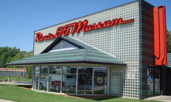
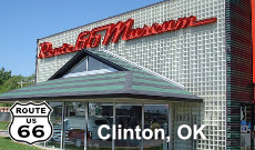
Oklahoma Route 66 Museum in Clinton, Oklahoma |
|
The Oklahoma Route 66 Museum is a popular stop in Clinton, Oklahoma. The state's official showcase of Route 66 is operated by the Oklahoma Historical Society, and offers visitors a spirited tour of pure Americana. |
|
 |
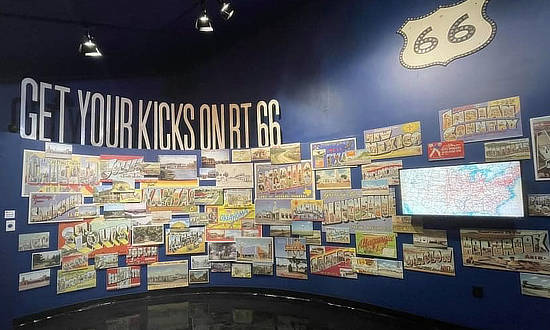 |
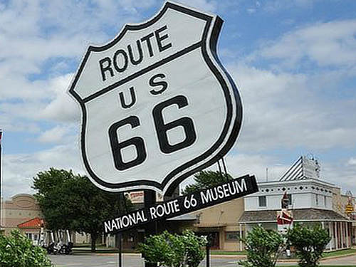
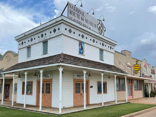
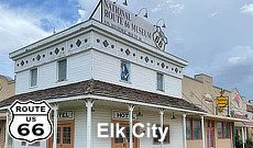
The National Route 66 Museum in Elk City, OklahomaThe National Route 66 Museum focuses on the people who lived, worked and traveled the “Mother Road” and offers visitors a classic walk through all eight states, highlighted by realistic murals and vignettes depicting the eras of the road and the interesting places that made Route 66 so famous. |
|
 |
 |
Lodging, Dining and Attractions in the Elk City Area
Hotels in/near Elk City with traveler reviews at TripAdvisor Elk City restaurant reviews at TripAdvisor Attractions and Things to Do in Elk City |
Erick, OklahomaLocated between Exits 9 and 10 on I-40, the Erick Tourism Information Center offers brochures and travel resources on statewide attractions, events, lodging and more. Enjoy clean restrooms, a vending area, advice from trained travel counselors, a gift shop and hundreds of free brochures and visitor guides. |
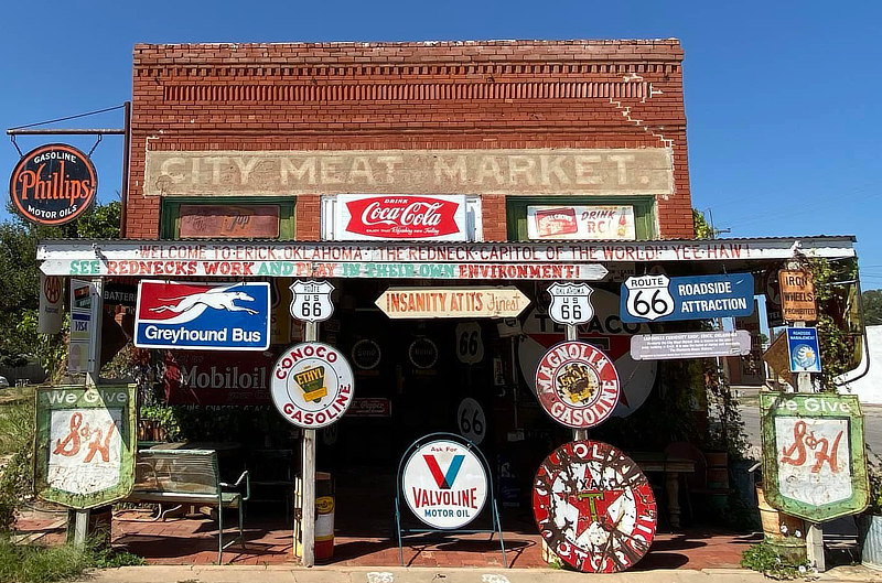
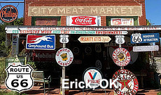
Sandhills Curiosity ShopLocated in the old City Meat Market in Erick, Oklahoma, at 201 S. Sheb Wooley Street, is the Sandhills Curiosity Shop ... Insanity at Its Finest! |
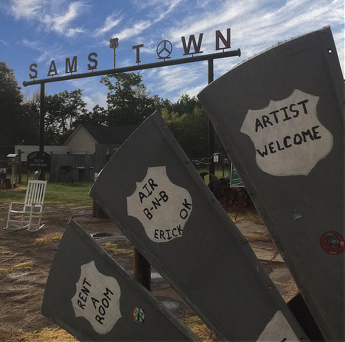
Sam's TownSam's Town is located at 401 W. Roger Miller Boulevard (Route 66) in Erick, one block west of Sheb Wooley Avenue. This captivating art installation tells the unique stories of Western Oklahoma's past. The site includes items collected and curated by renowned photographer Samuel Hagen. Sam's passion for this preservation makes it a must-see destination for those seeking to explore the rich tapestry of history and art that defines the iconic Route 66. It's a nice area located right on Route 66 where travelers can stop, rest a bit, stretch their legs and take a tour! Visit their Facebook page for AirBnB options for overnight stays. For more information, visit the website of Sam's Town and Sam's Town on Facebook ... phone 805.585.8333
|
Lodging Options Along Route 66 in Oklahoma
|
|
We also have divided the trip across Oklahoma Route 66 westbound into three major segments ... select your area of interest for more details, and also visit our Route 66 city pages!
|
Route 66 Road Trips in Oklahoma |
|
|
Tulsa to
Oklahoma City |
||
Oklahoma City to
Texas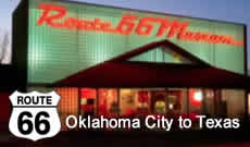 |
MORE OKLAHOMA ROUTE 66 |
||
 |
 |
 |
 |
 |
 |
 |
 |
 |
 |
 |
 |
 |
 |
 |
 |
||
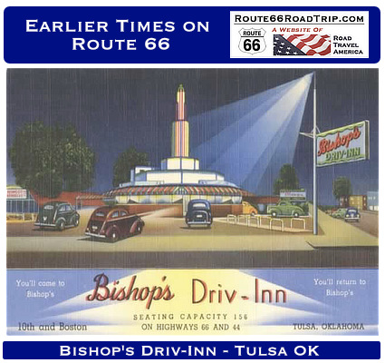
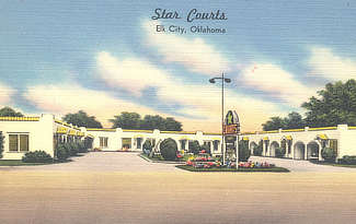
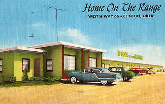
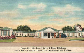
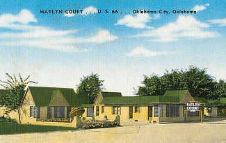
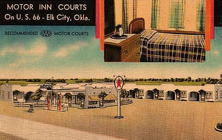
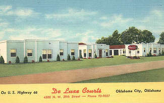
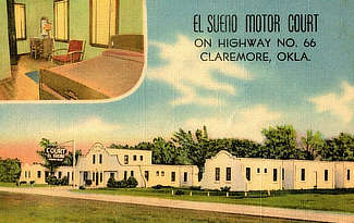
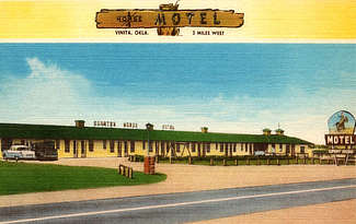
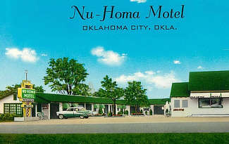
Earlier Times: Vintage Views along Route 66 in Oklahoma
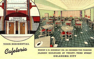
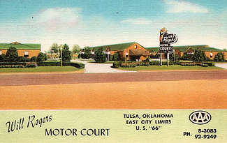
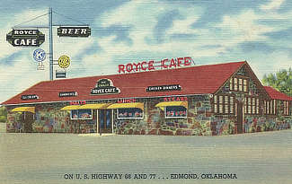
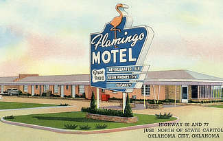
We have included below a sampling of our collection of vintage travel postcards dealing with Oklahoma and Route 66. What was Route 66 like in its earlier years, as visitors drove through and around Oklahoma? What did all the service stations, motels and public buildings look like when they were new? What did the traveling public experience on the Mother Road? We wonder such things when we travel Route 66 today. Those earlier times in the 1930s, 40s and 50s were not always captured on film. But the use of colorful postcards was common in those decades. These portray the historic road in its prime and help us to visualize, and appreciate, "earlier times" as we drive Route 66 today around Oklahoma. |
|||||||||||||||
|
Travel Guides for Other Segments of Route 66
Planning a Road Trip on Route 66? Here are the major segments ...
 |
|||
 |
 |
 |
 |
 |
 |
 |
 |
More About Route 66 Travel in Oklahoma
More Things to Do on Route 66 - at the Oklahoma Tourism Department
Oklahoma Historical Society: Route 66
