Route 66 New Mexico Travel Guide for 2026
We've had the opportunity to get out on the road and explore Route 66 all across New Mexico, the "Land of Enchantment".
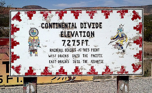
The segments across New Mexico on Route 66 totaled 487 miles at one point in time. Alignments varied over the years as the road was improved, and shortened. The road tended to follow the historic path of previous highways across the state, the 35th Parallel. New Mexico’s elevation along this route varies from a low of 3,800 feet at the Texas border to over 7,200 feet at the Continental Divide near Thoreau, creating a roadbed characterized by climbs, descents, switchbacks and cuts.
 |
Route 66 passed through these cities, towns and villages, heading east to west, depending on the year and route alignment:
- Glenrio
- San Jon
- Tucumcari
- Montoya
- Newkirk
- Cuervo
- Santa Rosa
- Santa Fe
- Albuquerque
- Los Lunas
- Laguna
- Budville
- Grants
- Continental Divide
- Gallup
 |
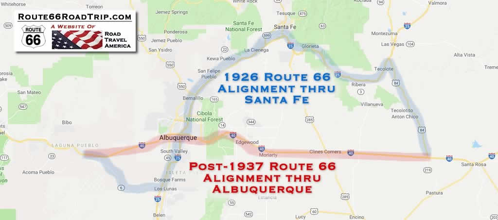
The original 1926 Route 66 alignment created a large "S Curve" as it headed north to near Las Vegas, then west to Santa Fe through Tecolate, Bernai, San Jose, Pecos and Glorieta Pass, and then back south to Albuquerque. In Santa Fe, Route 66 traveled along the Old Santa Fe Trail, passing the San Miguel Mission and Loretto Chapel and across the Santa Fe River to the historic LaFonda on the Plaza Hotel.
The 1926 alignment came into Albuquerque from Santa Fe on Highway 313, and ran through downtown north-to-south along 4th Street. Today the Barelas-South Fourth Street Historic District just south of downtown is a popular attraction, with shops, restaurants and other businesses.
Route 66 then continued south to Los Lunas, where it turned west to Laguna.
The 1926 alignment was replaced in 1937 with a more direct westward route into Albuquerque along Central Avenue, and then from Albuquerque directly to Laguna, and beyond to Gallup, following the current route of I-40 in many locales.
With realignments and road improvements, the distance of Route 66 in New Mexico was reduced to 399 miles by 1938, and Santa Fe was removed from the Mother Road.
Driving time today to travel the 280 miles from Amarillo to Santa Fe is about four hours via I-40 to Cline's Corners, and then north on U.S. 285. An alternate route is to take Exit 256 off I-40 onto U.S. 84 north after Santa Rosa; U.S. 84 then connects with I-25 to Santa Fe.
Map showing places along an early alignment of U.S. Route 66 across New Mexico, from Glenrio to Gallup The Route 66 Road Trip website is a participant in the Amazon Services LLC Associates Program, an affiliate advertising program designed to provide a means for sites to earn fees by advertising and linking to Amazon.com and affiliated sites. Amazon offers a commission on products sold through their affiliate links. There is no additional cost to you.

Best-Selling Route 66 Books and Maps at our Amazon Store
Route 66 Travel Guide - 202 Amazing Places
by Mark Watson
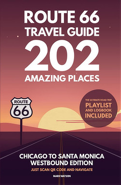
Route 66 Full-throttle Adventure Handbook,
by Drew Knowles
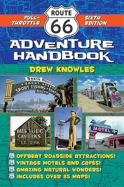
EZ66 Guide for Travelers (5th Edition)
by Jerry McClanahan
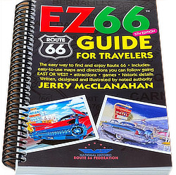
Rand McNally 2026 Road Atlas Large Scale
Spiral Bound
About These Products
Route 66 alignments in central New Mexico in 1926 and post-1937
Interactive Map of Route 66 in New Mexico
Heading Westbound at the Texas-New Mexico Border: The Ghost Town of Glenrio
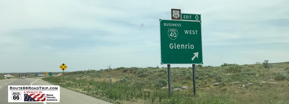 Present day Exit 0 from I-40 to Glenrio, on the Texas - New Mexico border |
Sitting directly on the Texas - New Mexico border at Exit 0 is the abandoned ghost town of Glenrio. The townsite still has noticeable traces of Route 66 and the motels and restaurants that used to thrive there before the arrival of I-40. Just west of Glenrio, Route 66 bridges are still visible to the alert I-40 traveler.
New Mexico Road & Recreation Atlas  |
Originally a railroad town, the village was renamed from Rock Island to Glenrio by the Rock Island and Pacific Railroad in 1908, and began receiving motorists driving the Ozark Trail in 1917. Its original structures were adobe buildings. The Rock Island Railroad depot closed in 1955, and the opening of Interstate 40 in 1975 further accelerated the demise of Glenrio.
The Glenrio Historic District encompasses the Route 66 roadbed and 17 abandoned structures. Remains can still be seen of an old motel, cafe, service station, the post office, and a few other buildings, as well as the old Route 66 roadbed. Some structures are posted, so in respect for owners and residents, please observe any "No Trespassing" signs.
Visitors today will notice construction underway in Glenrio. Parts of the area have been purchased and are slated for redevelopment. Read more:
- Business partners invest in abandoned town of Glenrio to revitalize the area (KFDA Amarillo)
- Glenrio Smoke Stop (in New Mexico)
For those traveling westbound, be sure to stop at the nicely designed and operated New Mexico Welcome Center. It is stocked well with maps and brochures about Route 66 and all of New Mexico; friendly staff members are always available to answer questions.
The old Route 66 then continued westward from Glenrio through San Jon, Tucumcari, Montoya, the ghost town of Cuervo and Santa Rosa.
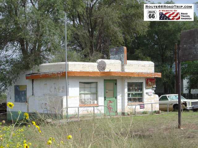 Brownlee Diner in Glenrio |
|
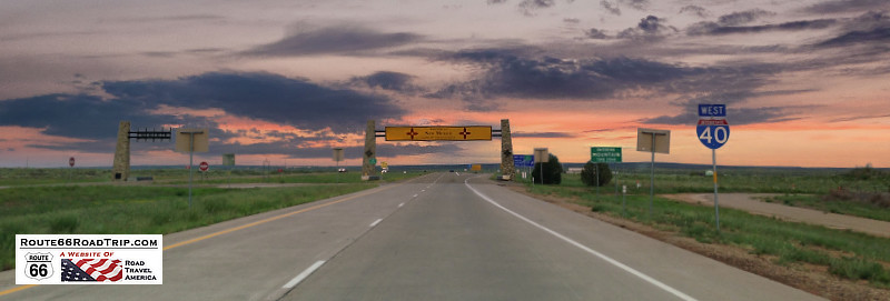
Entering New Mexico westbound at Glenrio |
Just Across the Border into New Mexico
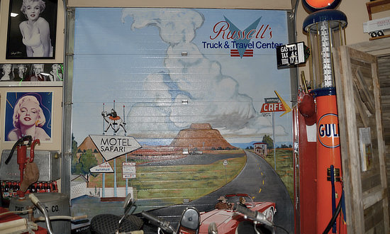
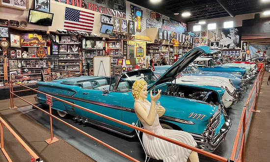
Located on Historic Route 66, family-owned Russell's Truck & Travel Center offers a complete grocery store, an authentic Route 66 Diner, a classic car and memorabilia museum, a chapel, and great showers. It is located at 1583 Frontage Rd 4132, Glenrio, NM 88434. Take I-40 Exit 369 (Highway 392).
It was purchased in 2023 by Travel Centers of America (TA). Read more at the Russell's Travel Center website.
Russell's Truck & Travel Center near Glenrio, New Mexico ... now a TA Travel Center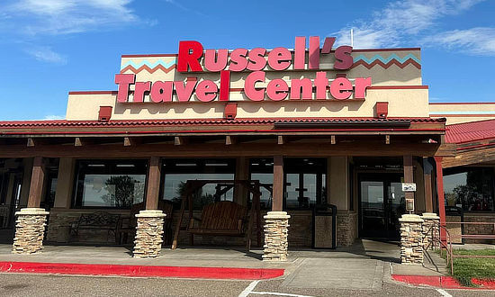 |
|
|
 |
 |
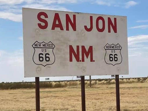
San Jon, NMThe next place of note is San Jon, located at I-40 Exit 356 (Highway 469). A small village, with a population of about 200 residents, it does offer a couple of gas stations and a restaurant. The village was founded in 1902 and grew after the arrival of the railroad in 1904. It was also an important stop on U.S. Route 66, with many a tourist-related businesses such as service stations, cafes and motels.
A fun stop in San Jon is the World's Largest Flip Flop Gift Shop!
|
Tucumcari Travel Highlights
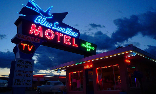 The Blue Swallow Motel, Tucumcari, New Mexico The Blue Swallow Motel, Tucumcari, New Mexico |
Leaving Glenrio, and back on I-40, we drive 42 miles and arrive at Tucumcari with its variety of vintage motels and electric neon signage.
For many years, Tucumcari has been a popular stop for cross-country travelers on Interstate 40 and previously Route 66. Numerous businesses, including gasoline service stations, restaurants and motels, were constructed to accommodate tourists as they traveled through on the Mother Road.
Today, Old U.S. Route 66 runs through the heart of Tucumcari via Route 66 Boulevard. A large number of the vintage motels and restaurants built in the 1930s, 1940s, and 1950s are still in business.
Tucumcari offers a variety of lodging options, and features over twenty motels for the traveling public, including the historic and well-known Blue Swallow Motel. Many "one-of-a-kind" properties are available as well as nationally operated chain facilities. Several are in the city, others offering great views of area lakes. Long famous for its number and variety of motels and lodging, the city adopted the "Tucumcari Tonite" advertising campaign.
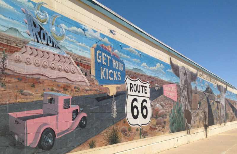
And Tucumcari is known for its murals painted on area buildings; more than twenty have been painted thus far.
The "Get Your Kicks on Route 66" mural in Tucumcari |
|
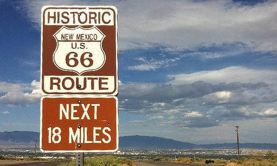 |
Town of Cuervo
As we leave Tucumcari, we head west again, for 41 miles. Cuervo, New Mexico is an old Chicago, Rock Island and Gulf Railroad town that today is mostly abandoned, although some residents still live there.
The railroad siding was built in 1902 and named "Cuervo". The post office was opened that same year.
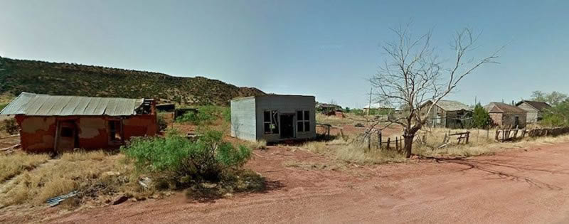
Most of the town is on the south side of I-40, between the interstate and the hills to the south. A variety of old buildings, houses and churches survive today. A ghost town? Not quite, but close!
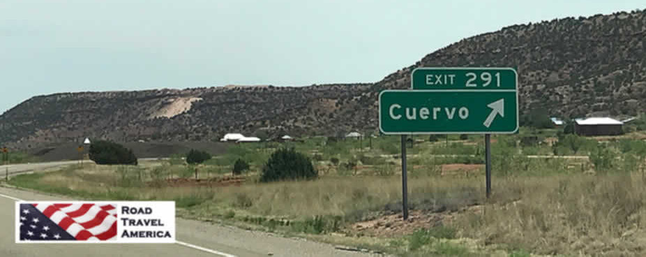
Exit 291 from I-40 to Cuervo, New Mexico
Scene from present-day Cuervo, New Mexico
A Stopover in Santa Rosa
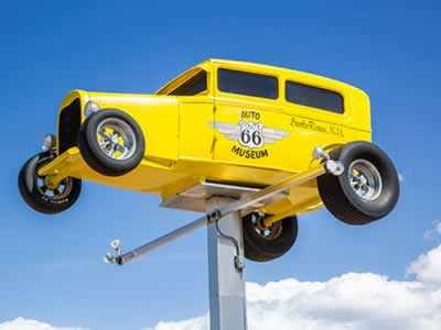 Route 66 Auto Museum, Santa Rosa, New Mexico |
Only 18 more miles and we arrive in Santa Rosa, located on the Pecos River.
When Route 66 passed through Santa Rosa in 1930, numerous service stations, cafés and motor courts were built to accommodate motorists traveling the Mother Road.
Driving down Santa Rosa’s Historic Route 66 today, travelers see many old signs and buildings … remnants of the days when the bright neon lights were a welcome sight to weary travelers looking for great food and comfortable lodging.
Santa Rosa still delivers that down-home, Main Street USA friendliness. It offers classic Route 66 cars and neon, the best in fishing, boating and water skiing, camping, and a place for a cool swim in the Blue Hole.
One of the popular local attractions is the Route 66 Auto Museum, which draws car buffs from all over the country and beyond. The museum houses a large collection of classics, low riders, muscle cars and motorcycles … plus, gas pumps and other auto memorabilia from the early days of Route 66.
The Santa Rosa Information Center can assist with maps, event information, recreation opportunities, dude ranches, rodeos, local southwest history, the geology of the world-famous Blue Hole and in locating Route 66 alignments and remnants of the road.
Santa Rosa offers a variety of hotels, inns, RV parks and campsites for visitors to the area.
Nearby Santa Rosa Lake State Park is the place to be for camping, boating, water skiing, jet skiing, swimming, hiking, biking and so much more! The world famous Blue Hole offers all sorts of water-based sports, including diving, swimming, snorkeling and scuba diving ... see photo below. |
||
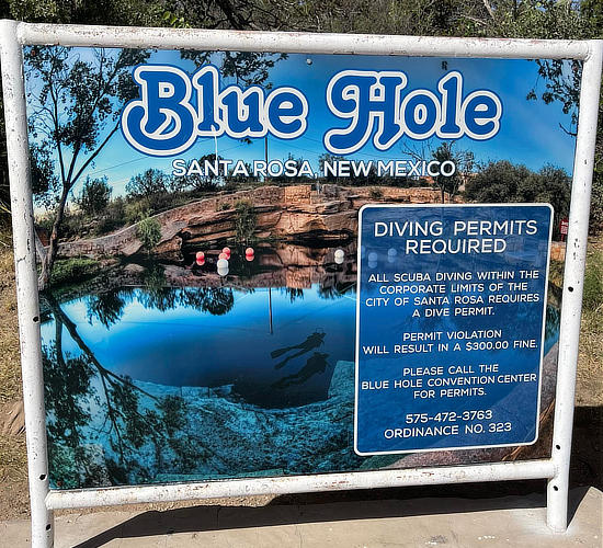 |
|
|
Hotels and Lodging Options in Santa Rosa
|
Santa Rosa hotels, reservations and traveler reviews at TripAdvisor |
Two Route 66 Alignments to Follow Leaving Santa Rosa
As one leaves Santa Rosa today heading west, there are two options to follow:
- The 1926 alignment through Santa Fe to Albuquerque
- The post-1937 alignment through Clines Corners and Moriarty to Albuquerque
Approximately 507 miles long in 1926, the alignment of Route 66 in New Mexico was reduced to 399 miles by 1938 bypassing Santa Fe.
The longest sections of the initial alignment created a large "S curve" as the road stretched across the middle of the state.
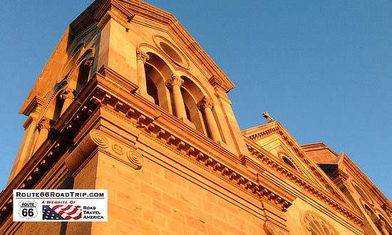 A must-see attraction in downtown Santa Fe ... the Cathedral Basilica of St. Francis of Assisi |
Arriving in Santa Fe on the 1926 Alignment
Once in Santa Fe, Route 66 passed through the heart of downtown, along side the historic LaFonda on the Plaza Hotel.
The Santa Fe Trail was a 19th-century transportation route through central North America that connected Independence, Missouri with Santa Fe. It served as a vital commercial highway until the introduction of the railroad to Santa Fe in 1880. Santa Fe was also near the end of the El Camino Real de Tierra Adentro which carried trade from Mexico City.
Santa Fe remained on the original Route 66 until 1938 when the road was rerouted on a more direct route thru Clines Corners to Albuquerque.
Today, Santa Fe is located on Interstate Highway 25, about 65 miles northeast of Albuquerque. U.S. Highway 285 traverses with city in a north-south orientation. Santa Fe is the capitol city of New Mexico, and is positioned at 7,000 feet above sea level.
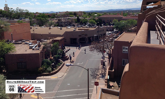
Route 66 in downtown Santa Fe, New Mexico
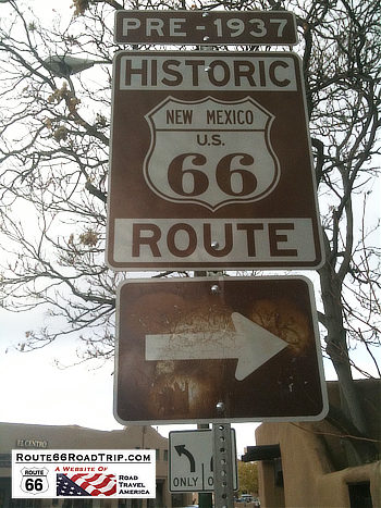
Route 66 Pre-1937 alignment sign in downtown Santa Fe, New Mexico
Museum of Indian Arts & Culture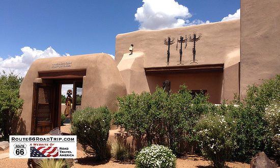 |
|
Lodging Options in Santa Fe
|
View all hotels in Santa Fe, read traveler reviews and make reservations
|
Leaving Santa Fe Southbound on Route 66
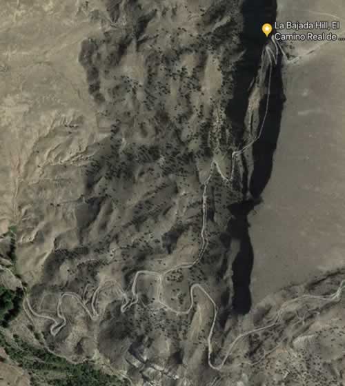 Aerial view of present-day La Bajada switchbacks on old Route 66 Aerial view of present-day La Bajada switchbacks on old Route 66 |
In Santa Fe, Route 66 traveled along the Old Santa Fe Trail, passing the San Miguel Mission and Loretto Chapel and across the Santa Fe River to the historic LaFonda on the Plaza Hotel.
From there it turned west on Water Street, and then left onto Galisteo Street and Cerrillos Road southward towards Albuquerque as shown in the map above.
The old route then passed the School for the Deaf and lodging properties like the El Rey Inn. Outside of town Route 66 followed the course of the Camino Real.
Leaving Santa Fe, Route 66 was relatively flat, as it traversed the La Bajada Mesa.
Route 66 Down La Bajada Hill
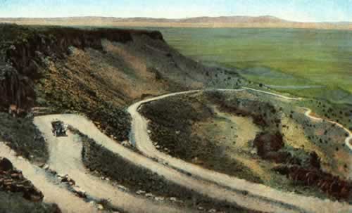
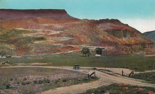
About 15 miles to the south, Route 66 made the steep, 500-foot descent down the La Bajada precipice in only two miles via a series of 26 switchbacks with a 28% grade.
Remnants of the switchbacks and their scar on the earth can still be seen by hikers and those in high-clearance, 4-wheel drive vehicles, and from satellite photos like the one shown to the right.
In 1932 Route 66 was moved about three miles to the east near the current route of Interstate 25.
Read more about La Bajada Hill and El Camino Real at the NPS website.
| Switchbacks on Route 66 at La Bajada Hill between Santa Fe and Albuquerque View from the top of the mesa looking south (left) and from the bottom looking north (right) |
|
 |
 |
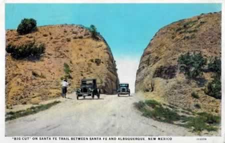
The "Big Cut" on Route 66
|
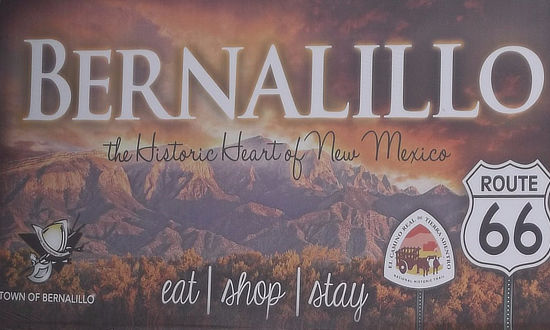
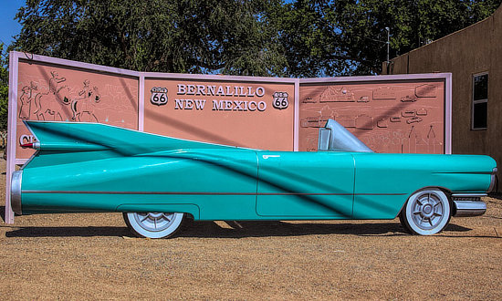
Bernalillo ... The Historic Heart of New MexicoThe 1950s Cadillac and Route 66 sign in Bernalillo, New Mexico, along the 1926 to 1937 Route 66 alignment between Santa Fe and Albuquerque ... near 241 S. Camino Del Pueblo in Bernalillo ... a great photo op! |
|
 |
 |
Visiting Albuquerque, New Mexico
 Click to read more about Route 66 in Albuquerque |
The original length of Route 66 in New Mexico in 1926 was about 507 miles. Funding for a straighter, shorter route was approved in 1931.
The 1926 Route 66 alignment came into Albuquerque from the north on Highway 313, and ran through downtown along 4th Street north-to-south. Today the Barelas-South Fourth Street Historic District just south of downtown is a popular attraction, with shops, restaurants and other businesses. Route 66 then continued south to Los Lunas, where it turned west to Laguna.
This alignment was replaced in 1937 with a more direct westward route from Albuquerque to Laguna, and beyond to Gallup, following the current route of I-40 in many locales.
The 1937 alignment also bypassed Santa Fe, coming in directly from the east into downtown Albuquerque, running west-to-east on Central Avenue. Dozens of motels, cafes, gift shops and restaurants spring up along the route. Some of these vintage motels remain, and historic neon signs still glow on old Route 66 through Albuquerque.
Today, tourism is a big industry in Albuquerque, hosting events such as the International Balloon Fiesta. It offers a variety of attractions such as the Sandia Peak Tramway, Indian Pueblo Cultural Center, National Museum of Nuclear History, San Felipe de Neri Church and Albuquerque Old Town.
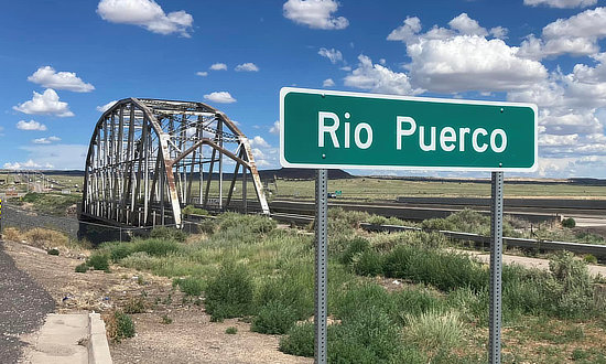
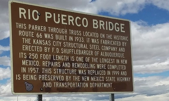
| Historic Route 66 Rio Puerco Bridge just west of Albuquerque | |
 |
 |
Lodging & Dining Options in Albuquerque
|
Hotels in Albuquerque with Traveler Reviews Albuquerque Travel Guide |
Budville, New Mexico
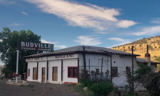
Travelers on old Route 66 between Albuquerque and Grants often make a stop at the Budville Trading Company for a photo op. For those traveling on Interstate I-40, use Exit 104, about 46 miles west of Albuquerque. The building housed one of the businesses operated by Howard Neal "Bud" Rice and was built in the late 1920s. |
 |
Best-Selling Route 66 Books and Maps at our Amazon Store |
|
| Route 66 Travel Guide - 202 Amazing Places by Mark Watson  |
Route 66 Full-throttle Adventure Handbook, by Drew Knowles  |
| EZ66 Guide for Travelers (5th Edition) by Jerry McClanahan  |
Rand McNally 2026 Road Atlas Large Scale Spiral Bound  |
About These ProductsThe Route 66 Road Trip website is a participant in the Amazon Services LLC Associates Program, an affiliate advertising program designed to provide a means for sites to earn fees by advertising and linking to Amazon.com and affiliated sites. Amazon offers a commission on products sold through their affiliate links. There is no additional cost to you. |
|
Grants, New Mexico
The City of Grants is located in Cibola County, roughly half-way between present-day Albuquerque and Gallup on Interstate 40.
Grants offers visitors a wealth of historical and recreational activities. Several attractions are located in the city, such as the New Mexico Mining Museum and the Route 66 Vintage Museum & Double Six Gallery. Nearby is the La Ventana Arch in the El Malpais National Conservation Area. The city sits at an elevation of 6,460', and is home to more than 9,000 residents.
A popular attraction today is the drive-thru neon Route 66 Arch, completed in 2016 and located off Exits 81 and 85. You park under the arch, and take "selfies" ... don't miss it!
Entering the Arch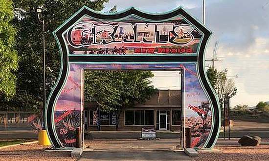 |
The "Selfie" side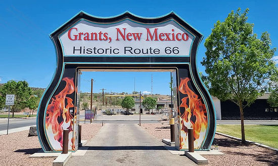 |
Lodging, Dining and Attractions in Grants ... from TripAdvisor
Grants Hotel Directory, Traveler Reviews and Reservations Grants Restaurant Listings and Reviews |
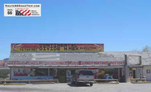
Continental Divide, New MexicoThoreau is located on old Route 66 and present-day Interstate 40 between Grants and Gallup. Just west of Thoreau, at Exit 47, is Continental Divide, at elevation 7,275 feet above sea level. |
|
Seen here is the the "Ya-Tah-Hey" gift shop, during a trip on this segment of Route 66 circa 2009. |
Continental Divide ... rainfall divides at this point, either to the Pacific or Atlantic Oceans |
Visiting Gallup, New Mexico
Gallup is the largest city between Albuquerque and Flagstaff, and has a population of about 22,000 residents. The city sits at an elevation of 6,512', and is known as the "most patriotic small town in America".
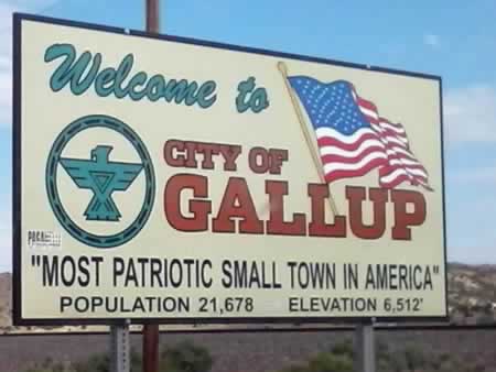 Welcome to the City of Gallup, New Mexico ... "Most Patriotic Small Town in America" |
It is located about 140 miles west of Albuquerque, and 185 miles east of Flagstaff, and only 23 miles from the Arizona-New Mexico border. The city is located in the middle of the Navajo Reservation.
Because of the nearby rugged terrain, it was a popular location in the 1940s and 1950s for Hollywood Westerns and has hosted many well-known movie stars such as John Wayne, Katharine Hepburn, Humphrey Bogart, Ronald Reagan and Kirk Douglas.
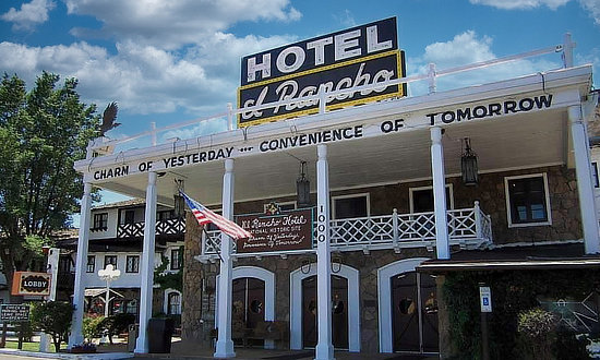
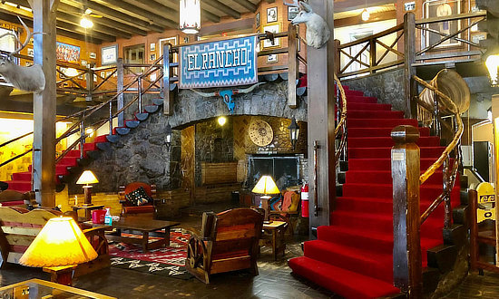
Restaurants such as the famous Hotel El Rancho reflect the western and Indian influences on the town.
Today’s visitors can partake in a meal at the El Rancho or enjoy an overnight stay and tour the memorabilia-lined grand lobby. Gallup has over 30 other hotels and over 90 restaurants and is a popular stopover point for those traveling Historic Route 66.
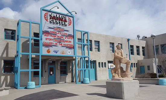
Area attractions include the Manuelito Visitor Center, the Navajo Code Talker Museum, the Gallup Cultural Center in the historic Santa Fe Railway depot, Red Rock Park & Museum, Bill Malone Trading Company and much more.
Shopping is also a big local attraction, with 110 trading posts, shops and galleries in Gallup, making the town the undisputed Southwestern center for authentic Native American art.
| Hotel El Rancho in Gallup, New Mexico ... "Charm of Yesterday ... Convenience of Tomorrow" | The Gallup Cultural Center offers diverse programming and arts that celebrate the Native American cultures | |
 |
 |
|
Retail stores in downtown Gallup, New Mexico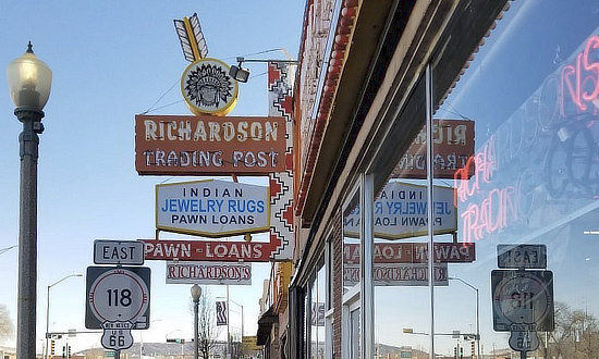 |
|
Lodging, Dining and Attractions in Gallup ... from TripAdvisor
|
Gallup Hotel Directory, Traveler Reviews and Reservations Gallup Restaurant Listings and Reviews |
Hotel El Rancho in Gallup, New Mexico"Charm of Yesterday ... Convenience of Tomorrow" R.E. Griff came to Gallup in the early 1930s and loved the stark landscapes, mesas and endless vistas. He built the Hotel El Rancho in 1936 and it soon became a popular staging area for Western movie productions. During the 1930s and 1940s over 100 Westerns were shot in the Gallup area, with numerous stars lodging at the El Rancho. The large guest list included John Wayne, Katherine Hepburn, Ronald Reagan, Mae West, Kirk Douglas and many more. Today, the popularity of the hotel remains and is a favorite stopping point for Route 66 travelers! The Silver Screen restaurant features an original ranch-style dining room with high ceilings, exposed wood beam trusses and rustic cowboy décor. The Silver Screen takes an uncomplicated approach to familiar favorites with an emphasis on traditional Southwestern flavors. It’s a fun, casual setting! The elegant 49er Lounge is a great place to unwind and cool down after a day of roadtripping on Route 66! The Hotel is located at 1000 East Highway 66 in Gallup ... phone 505.863.9311 For more information, visit the Hotel El Rancho Website and Hotel El Rancho on Facebook Rerad traveler reviews and view more photos about the Hotel El Rancho on TripAdvisor |
|
 |
 |
Clines Corners
The post-1937 Route 66 alignment cut about one hundred miles off the previous, 1926 alignment through Santa Fe. The road stretched west from Santa Rosa, and climbed over 2,400 feet by the time it arrived at Clines Corner.
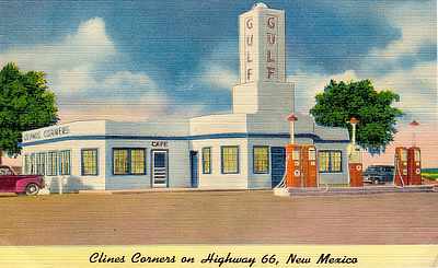
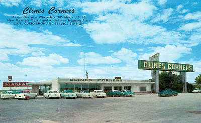
Roy Cline opened his rest stop in 1934 at the intersection of what was then New Mexico State Highways 6 and 2. For decades since, travelers have stopped at Clines Corners Travel Center for a needed break, fuel, or just their homemade fudge. Today, Clines Corners Retail Center spans over 30,000 square feet.
It is located at the intersection of I-40 and U.S. 285, 68 miles east of Albuquerque, at Exit 218. It offers gasoline, a restaurant, souvenirs and gift shop, large clean restrooms, RV park, and more! It's always worth a stop. The official address is 1 Yacht Club Drive, Clines Corners, NM, 87070. Phone: 575.472.5488, or visit the Clines Corners website
From Clines Corners, Route 66 continued west, through Moriarty, Edgewood, Tijeras, and into Albuquerque.
Vintage Views of Clines Corners
 |
 |
| Route 66 Road Trips in New Mexico | |
Tucumcari thru Santa Rosa to Santa Fe  |
Santa Fe thru Albuquerque to Gallup |
MORE NEW MEXICO ROUTE 66 |
||
 |
 |
 |
 |
 |
 |
Travel Guides for Other States Along Route 66
Planning a Road Trip on Route 66? Here are trip planners for all eight states on The Mother Road ...
 |
 |
 |
 |
 |
 |
 |
 |
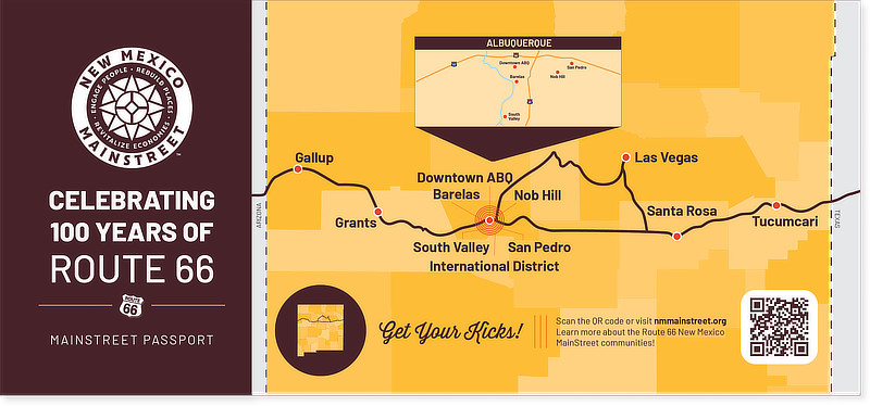
New Mexico Mainstreet (NMMS) Route 66 Centennial Passport
The NMMS Route 66 Centennial Passport program is a fun way to celebrate 100 years of Route 66 as part of your adventure along the Mother Road. Pick up your NM MainStreet Route 66 Centennial rack card and sticker at participating businesses — collect stickers from all ten districts for a keepsake of this historic celebration. The program runs January-December 2026, during the Route 66 Centennial. Read more at New Mexico Mainstreet Route 66 Passport website |
