Travel Guide for Santa Rosa on Route 66
A Stopover in Santa Rosa
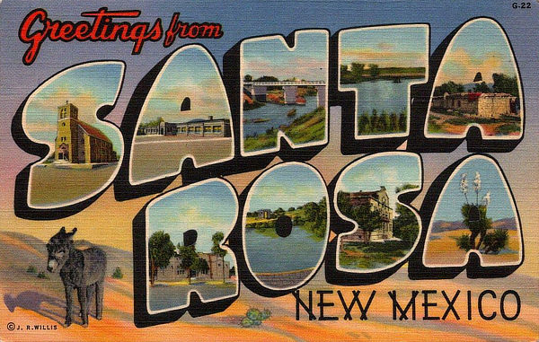 |
We've had the opportunity to get out on the road and explore Route 66 in New Mexico on numerous trips. Santa Rosa is located west of Tucumcari and east of Albuquerque.
When Route 66 passed through Santa Rosa in 1930, numerous service stations, cafés and motor courts were built to accommodate motorists traveling the Mother Road.
Driving down Santa Rosa’s Historic Route 66 today, travelers see many old signs and buildings … remnants of the days when the bright neon lights were a welcome sight to weary travelers looking for great food and comfortable lodging.
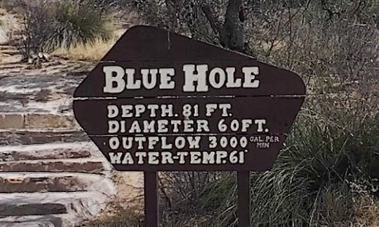
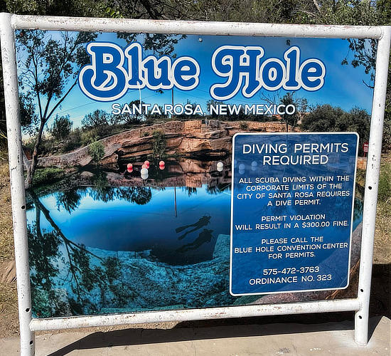
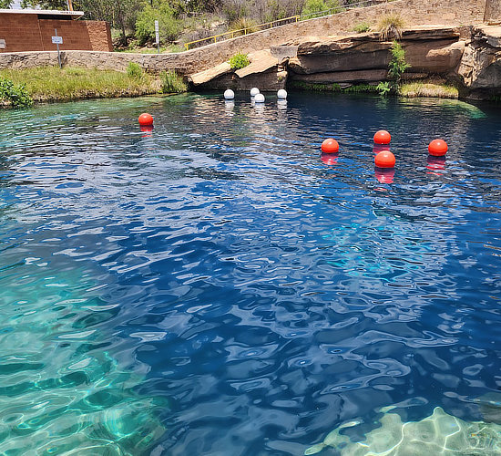
Santa Rosa still delivers that down-home, Main Street USA friendliness. It offers classic Route 66 cars and neon, the best in fishing, boating and water skiing, camping, and a place for a cool swim in the Blue Hole.
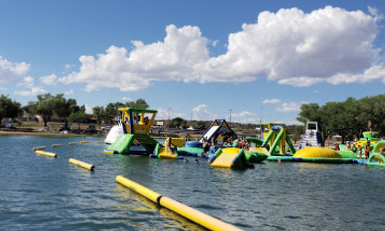
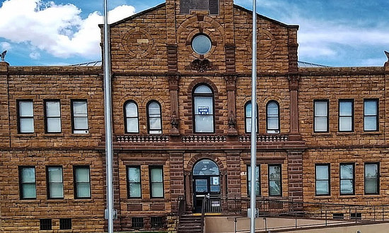
Located on the Pecos River, between Albuquerque and Amarillo, you can see picturesque stone buildings in the historic district, enjoy down-home meals, chill out with our waterslide and pedal boats at Park Lake, walk or bike-ride along recreational trails or on level sidewalks connecting the downtown plaza where the grand Guadalupe County Courthouse is a central landmark, along the Route 66 corridor or on improved trails through an extensive but compact City parks system.
The Santa Rosa Information Center can assist with maps, event information, recreation opportunities, dude ranches, rodeos, local southwest history, the geology of the world-famous Blue Hole and in locating Route 66 alignments and remnants of the road.
Santa Rosa offers a variety of hotels, inns, RV parks and campsites for visitors to the area.
Map showing the location of Santa Rosa, New Mexico on U.S. Route 66

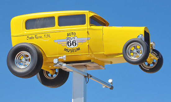
Route 66 Auto Museum
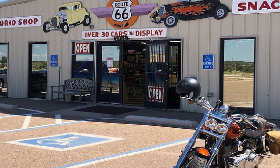
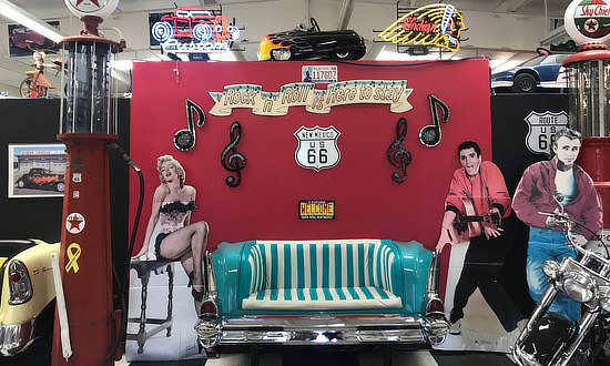
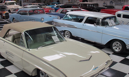
One of the popular local attractions is the Route 66 Auto Museum, which draws car buffs from all over the country and beyond. The museum houses a large collection of classics, low riders, muscle cars and motorcycles … plus, gas pumps and other auto memorabilia from the early days of Route 66.
Route 66 comes to life as you tour this iconic collection of vintage cars, trucks, toys, gas pumps, and memorabilia, all brought together to celebrate and remember the glory days.
There’s enough chrome, fins, and colorful finishes to give any car buff an unforgettable experience. A gift shop and snack bar are part of the experience as well.
For more information visit the Website of the Route 66 Auto Museum or phone 575.472.1966
 |
|
 |
 |
 |
 |
Hotels and Lodging Options in Santa Rosa
|
Santa Rosa hotels, reservations and traveler reviews at TripAdvisor Santa Rosa restaurant listing and reviews |
Santa Rosa Lake State Park
Nearby Santa Rosa Lake State Park is the place to be for camping, boating, water skiing, jet skiing, swimming, hiking, biking and so much more! Centered around Santa Rosa Lake, the state park is the best way to experience the beautiful desert scenery.
Veer off the Historic Route 66 to reach, where visitors can camp lakeside. Santa Rosa Lake is a man-made lake formed by the Santa Rosa Dam. The system creates a large reservoir with a surface area of 26 square miles. Visitors have plenty of room to explore the natural sights and wildlife living within the region.
The park has several hiking and walking trails. Visitors can walk through the desert landscape and grassland plains to see the flora and abundant wildlife. The trails are well-marked, making it easy to reach the points of interest, including incredible views of the lake and other natural scenery.
For more information visit the Website of Santa Rosa State Park
Santa Rosa Lake State Park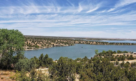 |
|
The Bridges of Santa Rosa
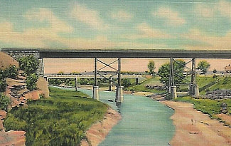
Several bridges cross over the Pecos River near Santa Rosa, including one that you can drive along Route 66. But there’s a lot of historical prominence to stopping by the original Pecos River Bridge. The Pecos River Bridge is a scenic railroad bridge built approximately 50-feet above the river. At one point, it was North America’s highest railroad bridge and still ranks among the top.
Pecos River Bridge is one of the most historical bridges in Santa Rosa and a famous local attraction.
Other Area Attractions
- James-Wallace Memorial Park and Power Dam
- Tres Legunas Golf course
- Trail of the Forty Niners
- James M. Casaus House
- Historic Puerto de Luna
- Pecos Theatre
Santa Rosa Scenic Historic Marker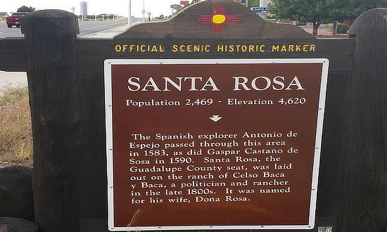 |
Santa Rosa Campground & RV Park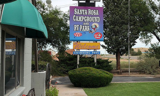 |
Best-Selling Route 66 Books and Maps at our Amazon Store |
|
| Route 66 Travel Guide - 202 Amazing Places by Mark Watson  |
Route 66 Full-throttle Adventure Handbook, by Drew Knowles  |
| EZ66 Guide for Travelers (5th Edition) by Jerry McClanahan  |
Rand McNally 2026 Road Atlas Large Scale Spiral Bound  |
About These ProductsThe Route 66 Road Trip website is a participant in the Amazon Services LLC Associates Program, an affiliate advertising program designed to provide a means for sites to earn fees by advertising and linking to Amazon.com and affiliated sites. Amazon offers a commission on products sold through their affiliate links. There is no additional cost to you. |
|
More Scenes Around Santa Rosa |
|
Approaching Santa Rosa on I-40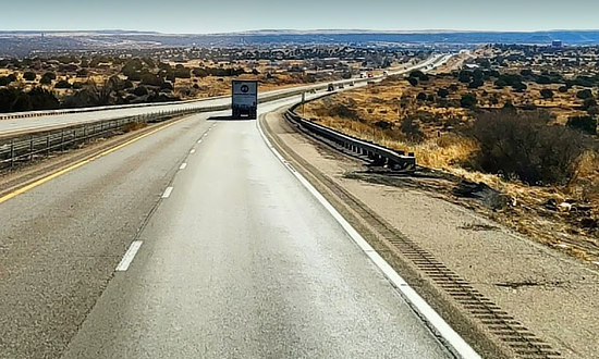 |
Santa Rosa Pre-1937 Route 66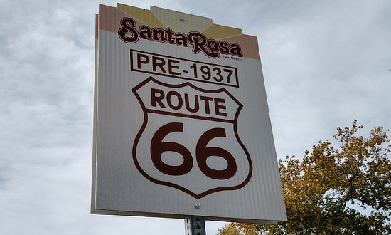 |
Park Lake in Santa Rosa
|
|
Guadalupe County CourthouseThe Historic Guadalupe County Courthouse, or the Santa Rosa Courthouse, was built in 1909. It’s located within the Shelbyville Court Square, on the corner of Parker Avenue and S. Fourth Street. |
|
Interactive Map of Santa Rosa, New Mexico
More Santa Rosa Information and Resources |
|
Two Route 66 Alignments to Follow Leaving Santa Rosa
As one leaves Santa Rosa today heading west, there are two options to follow:
- The 1926 alignment through Santa Fe to Albuquerque
- The post-1937 alignment through Clines Corners and Moriarty to Albuquerque
Approximately 507 miles long in 1926, the alignment of Route 66 in New Mexico was reduced to 399 miles by 1938 bypassing Santa Fe.
The longest sections of the initial alignment created a large "S curve" as the road stretched across the middle of the state, as shown in the map below.
Route 66 alignment in central New Mexico in 1926 and post-1937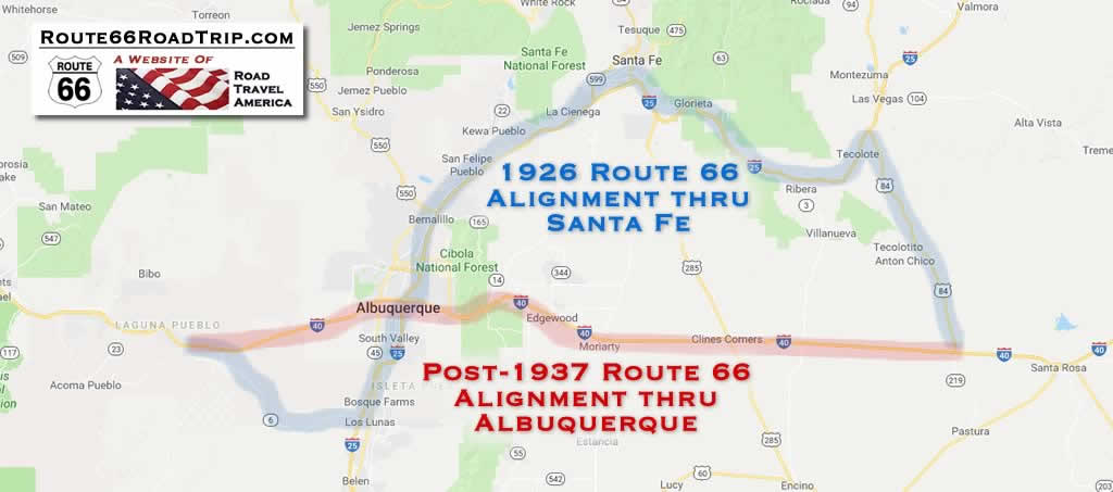 |
MORE NEW MEXICO ROUTE 66 |
||
 |
 |
 |
 |
 |
 |
Earlier Times: Vintage Views along Route 66 in Santa Rosa
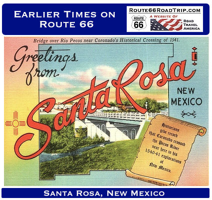
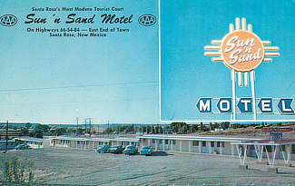
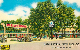
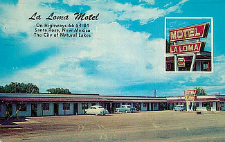
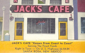
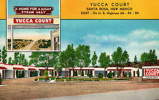
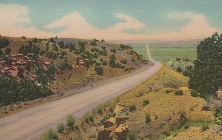
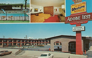
We have included below a sampling of our collection of vintage travel postcards dealing with Santa Rosa and Route 66. What was Route 66 like in its earlier years, as visitors drove around and across Santa Rosa? What did all the service stations, motels and public buildings look like when they were new? What did the traveling public experience on the Mother Road? We wonder such things when we travel Route 66 today. Those earlier times in the 1930s, 40s and 50s were not always captured on film. But the use of colorful postcards was common in those decades. These portray the historic road in its prime and help us to visualize, and appreciate, "earlier times" as we drive Route 66 today across Santa Rosa. |
|||||||||
|
