Road Trip on Route 66 from Seligman to Kingman, Arizona
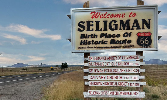 Welcome to Seligman ... "Birth Place of Historic Route 66" Welcome to Seligman ... "Birth Place of Historic Route 66" |
One of the original U.S. Highways, Route 66 was established on November 11, 1926, stretching 2,448 miles.
Route 66 served as a major path for those who migrated west.
One of our favorite segments along the Mother Road stretches 87 miles from Seligman westward to Kingman in Arizona.
Seligman is located on Historic Route 66, between Flagstaff and Kingman, just north of the present-day I-40. It is situated at an altitude of 5,242', and has a population of about 450 residents.
On this leg of Route 66 we will pass through the small towns of Yampai, Peach Springs, Truxton, Valentine and Hackberry on the way.
Kingman is located on Historic Route 66, Interstate 40, U.S. Route 93, and Arizona Highway 68. With its geographical location, it provides access to the gambling destinations of Las Vegas and Laughlin, Nevada, as well as the Grand Canyon, California, the Colorado River, Lake Mead National Recreation Area, Lake Mohave, and Lake Havasu. It also is an Amtrak stop.
The original 1926 Route 66 alignment ran southwest out of Kingman through Cool Springs to Oatman, and onward to Golden Shores and Topock where it turned west to Needles, California.
In 1952, the Route 66 alignment was changed, running from Kingman through the small town of Yucca and then into California. This alignment is essentially the same as present-day I-40 from Kingman to the Colorado River at California. Read more about the 1952 Route 66 Alignment from Kingman to Topock
Map of Route 66 from Seligman to Kingman, Arizona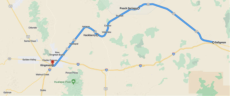 |
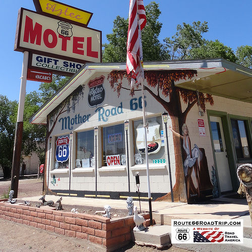 The Aztec Motel and Gift Shop in Seligman on Historic Route 66! The Aztec Motel and Gift Shop in Seligman on Historic Route 66! |
Starting Point: The Old Railroad Town of Seligman, Arizona
Seligman's earlier roots was as a railroad town.
Originally Seligman was called “Prescott Junction” because it was the railroad stop on the Santa Fe Railroad mainline junction with the Prescott and Arizona Central Railway Company.
In 1886 it was renamed Seligman, after Jesse Seligman, one of the founders of J.W. Seligman Co. of New York, who helped finance the railroad lines in the area.
In 1987 Seligman became known as the “Birthplace of Historic Route 66”.
Today, Seligman is home to numerous gift shops, restaurants and several small motels. It is truly a step back in time!
Angel & Vilma's in Seligman, Arizona
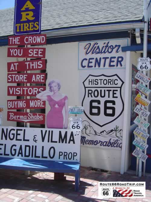 |
In 1972, Angel Delgadillo moved his barber shop so that he could take advantage of the traffic on the new alignment of Route 66 through Seligman.
Business was good until September of 1978, when I-40 bypassed Seligman.
To stimulate tourism, Angel, his wife Vilma, and other shop owners in northwest Arizona established the Historic Route 66 Association of Arizona.
The Association was located in Angel's Barber Shop & Pool Hall.
His work helped make Seligman "The Birthplace of Historic Route 66".
We've shopped there, and highly recommend it!
Elvis and friend on a break on Historic Route 66 in Seligman, Arizona

The famous yellow Edsel taxi, Historic Route 66 in Seligman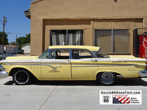 |
The Route 66 Motoporium ... A shopping paradise!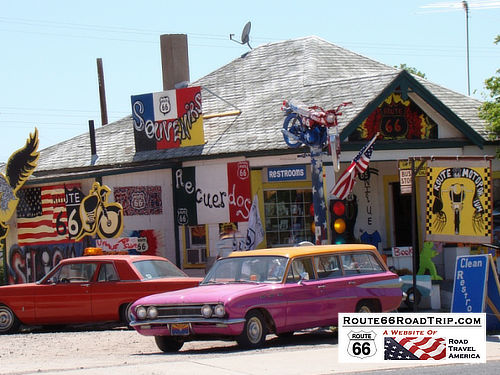 |
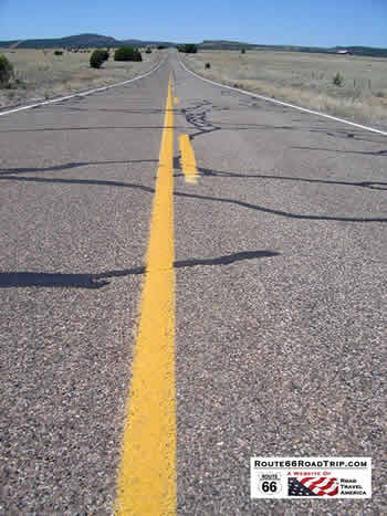 Touching The Mother Road: Stopping for a close-up and personal view of Route 66 just northwest of Seligman Touching The Mother Road: Stopping for a close-up and personal view of Route 66 just northwest of Seligman |
Traveling Westbound on Route 66 from Seligman in Arizona
Heading westbound in Arizona, Route 66 takes a northwestern turn at Seligman, away from today's Interstate 40, and passes through the small towns of Yampai, Peach Springs, Truxton, Valentine and Hackberry.
West of Seligman the road settles into the Aubrey Valley, and then nears Grand Canyon Caverns.
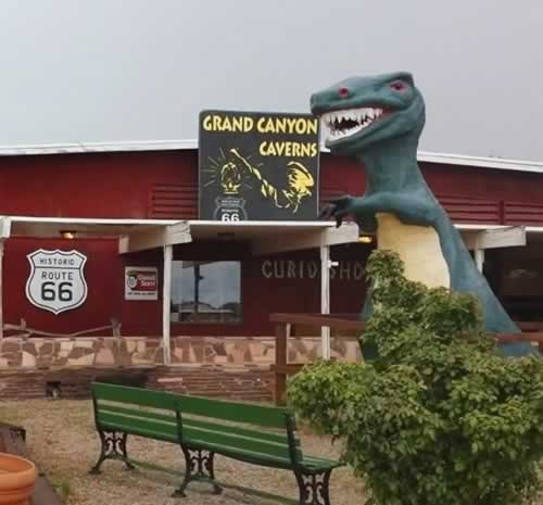
Next up is Peach Springs, a Hualapai Tribe community, and views of the Music Mountains and Laughing Jack Butte. Tours of the Grand Canyon Caverns are located nearby.
The small towns of Truxton, Valentine and Hackberry are next ... be sure to stop at the Hackberry General Store for a drink and Route 66 souvenirs.
The final stretch runs through the Hualapai Valley and southwest into Kingman.
We've been to Seligman on several occasions, and have made the trip to Kingman on the old road. There is typically no traffic, and it is an easy drive.
This is a highly recommended segment of Route 66, where travelers can slow down and sense what the Mother Road was like in her prime!
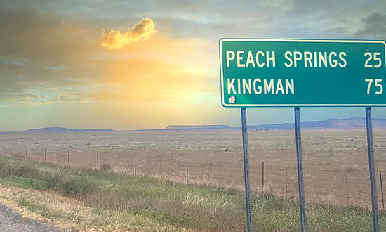
Quiet scene along Route 66 between Seligman and Kingman, Arizona

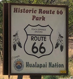
Peach Springs, ArizonaPeach Springs has a population of 1,090 residents and serves as the administrative headquarters of the Hualapai people. It is located on the Hualapai Reservation. Also of interest to travelers is the Hualapai Lodge located in Peach Springs. Seen to the right is the sign at the Historic Route 66 Park in Peach Springs. The nearby Grand Canyon Caverns Inn offers a variety of lodging, a restaurant, cavern tours, trips to Supai and the waterfalls as well as RV parking/camping. |
 |
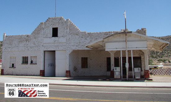
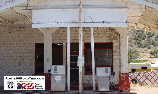
Jon Osterman Gas StationShown below is the John Osterman Gas Station, Peach Springs, on Route 66, as seen in May of 2012. It was constructed in 1929 by hand using a concrete block kit from the Sears-Roebuck catalog. Over the years it has been not only a place to sell gas and service vehicles along Route 66 but a focal point for generations of the Hualapai Tribal community. Today, in 2023, the building is deterioating, and needs stabilization and rehabilitation. The historic station has been listed on the annual list of the National Trust for Historic Preservation’s "11 Most Endangered Historic Places". The Tribe is developing a preservation and reuse plan and raising funds to save the Hualapai-owned gas station. |
|
 |
 |
Grand Canyon CavernsThe Grand Canyon Caverns, located just a few miles east of Peach Springs, Arizona, lie 210 feet below ground level. They are among the largest dry caverns in the United States.
|
Hackberry, ArizonaStopover in Hackberry, Arizona ... Hoping to make the entire Route 66 between Seligman and Kingman before a breakdown! Read more about the Hackberry General Store on Arizona Route 66 |
|
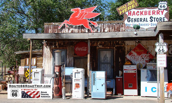
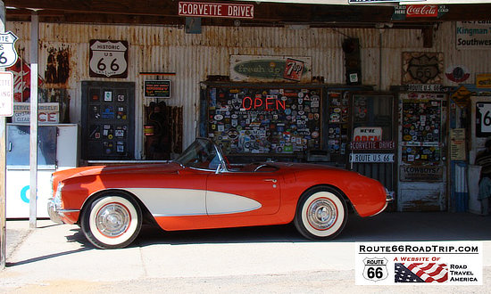
Corvette Drive at Hackberry, Arizona,
between Seligman and Kingman on U.S. Route 66 |
Arizona Road & Recreation Atlas  |
Best-Selling Route 66 Books and Maps at our Amazon Store |
|
| Route 66 Travel Guide - 202 Amazing Places by Mark Watson  |
Route 66 Full-throttle Adventure Handbook, by Drew Knowles  |
| EZ66 Guide for Travelers (5th Edition) by Jerry McClanahan 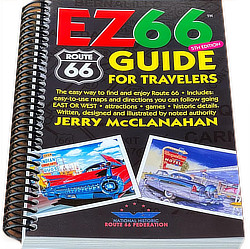 |
Rand McNally 2026 Road Atlas Large Scale Spiral Bound  |
About These ProductsThe Route 66 Road Trip website is a participant in the Amazon Services LLC Associates Program, an affiliate advertising program designed to provide a means for sites to earn fees by advertising and linking to Amazon.com and affiliated sites. Amazon offers a commission on products sold through their affiliate links. There is no additional cost to you. |
|
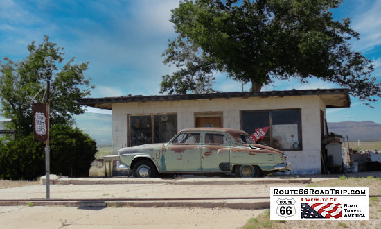
Stopped Along Route 66The green Studebaker in Truxton, Arizona, ready to travel on Historic Route 66 between Seligman and Kingman! |
 |
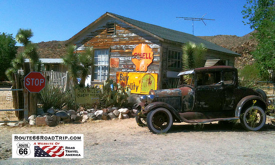
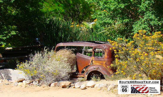
The Rusted AutomobileOn Route 66 near Hackberry, east of Kingman, Arizona |
 |
Lodging Options Along Route 66
|
Read traveler reviews and see photos on 40 hotels in Kingman Kingman Travel Guide at TripAdvisor: Lodging, restaurants, things to do |
Welcome to Historic Downtown Kingman, Arizona ... the Heart of Route 66 |
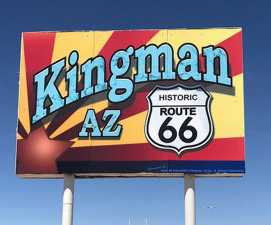
Arrival in Kingman Arizona on Route 66
 Route 66 water tower in Kingman Route 66 water tower in Kingman |
The City of Kingman is the county seat of Mohave County, and has a population of about 28,000 residents, while the entire metro area accounts for about 66,000 residents.
Kingman is located on Historic Route 66, Interstate 40, U.S. Route 93, and Arizona Highway 68.
With its geographical location, it provides access to the gambling destinations of Las Vegas and Laughlin, Nevada, as well as the Grand Canyon, California, the Colorado River, Lake Mead National Recreation Area, Lake Mohave, and Lake Havasu. It also is an Amtrak stop.
Popular attractions include the Historic Route 66 Museum and the Kingman Railroad Museum.
For aviation fans, make a stop at the Kingman Airport on the north side of town. It is a major airplane boneyard and storage facility for commercial airliners.
The Kingman area is served by about 35 hotels and motels, and over 100 restaurants, diners and cafes.
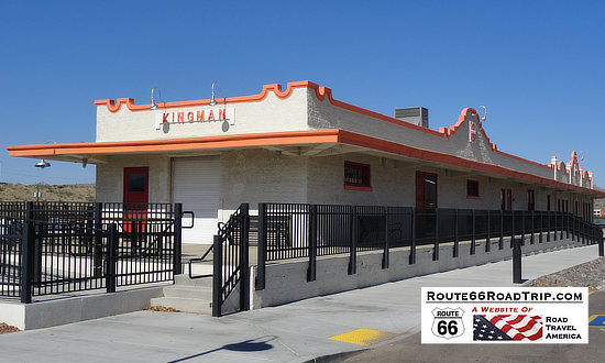
Railroad StationThe one-story Spanish Mission style station in downtown Kingman was built in 1907 by the Atchison, Topeka and Santa Fe Railway—commonly referred to as the “Santa Fe.” |
|
|
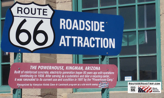
The PowerhouseThe Powerhouse roadside attraction in Kingman, Arizona, and Historic Route 66. Inside is the Arizona Route 66 Museum, at 120 W. Andy Devine Avenue.
|
Mohave Museum in Kingman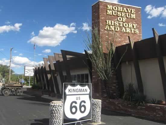 |
Rt 66 Motorcycle Parts & Accessories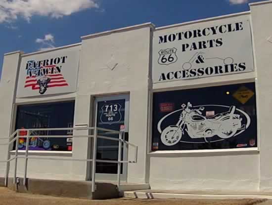 |
Mother Road Harley-Davidson mural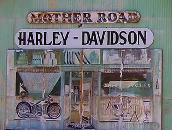 |
Mural in Kingman, Arizona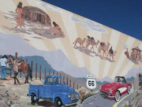 |
The Hill Top Motel in Kingman, Arizona - "Best View in Kingman"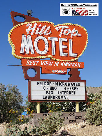 |
Historic Route 66 mileage chart, east and west, from Kingman, AZ 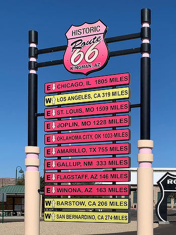 |
MORE ARIZONA ROUTE 66 |
|||
 |
 |
 |
 |
 |
 |
 |
 |
Travel Guides for Other States Along Route 66
Planning a Road Trip on Route 66? Here are trip planners for all eight states on The Mother Road ...
 |
 |
 |
 |
 |
 |
 |
 |
Trending Trips Near Route 66 on Our Related Website |
|||
 |
 |
 |
 |
