Route 66 Side Trip Along the Turquoise Trail
For many years as we were planning our next road trip, we always wondered "Where is the Turquoise Trail" that we keep hearing about!
On our next trip on Route 66 to Santa Fe we discovered the Turquoise Trail, and drove it from Santa Fe southward to Tijeras, and headed westbound through Albuquerque to drive on Historic U.S. Route 66 to Gallup and into Arizona.
Many travelers on Historic Route 66 make a once-in-a-lifetime side trip along the Turquoise Trail, from Tieras near Route 66 northward to Santa Fe.
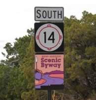 New Mexico Scenic Byway 14 ...The Turquoise Trail |
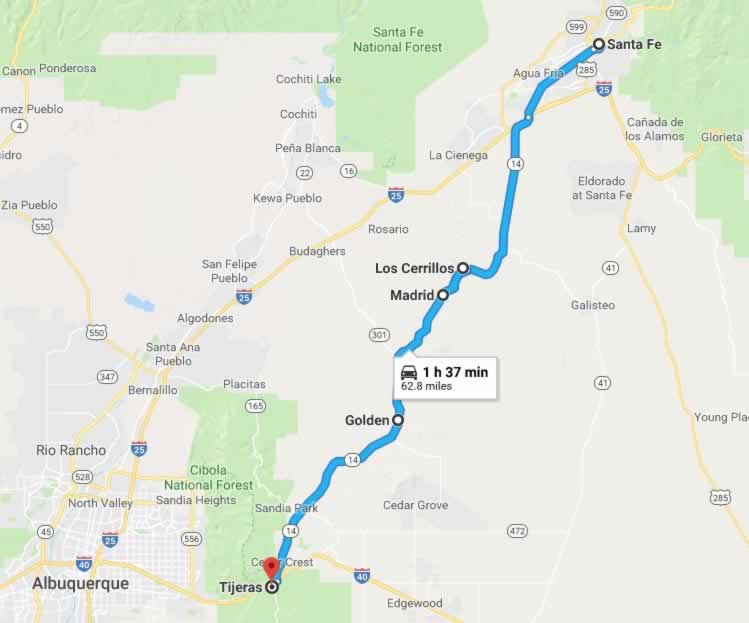
The Turquoise Trail is officially New Mexico Highway 14, and is designated a Scenic Byway. It stretches about 63 miles from Tijeras near Route 66 northward to Santa Fe. Driving time is about 1:35 nonstop ... but who would want to drive this interesting route from end to end with so much to see and do in between?
We have since driven the trail several times, from north to south, and south to north, stopping many times along the way to shop, dine or have photo ops. Traffic is never a problem, and it is a peaceful drive through rugged New Mexico countryside.
Tourists encounter several interesting small towns and communities along the way, filled with shops and dining opportunities. Begining this trip near Tijeras, and heading north, the trail travels through San Antonito, Golden, Madrid, Los Cerrillos, and into Santa Fe on Cerillos Road..
Spend a day, or more, and enjoy and explore the Turquoise Trail before resuming your road trip on Route 66!
The Village of Tijeras
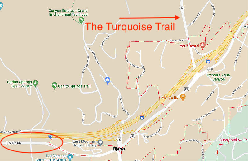
Two canyons come together at Tijeras, the Spanish name for scissors. Tijeras Canyon, leads west towards Albuquerque, and Cedro Canyon, leads south to the Manzano Mountains as The Salt Mission Trail. The deep canyon that separates Sandia and Monzano Mountains contains the eastbound and westbound lanes of I-40 and a popular portion of old Route 66, that parallels I-40 from Albuquerque west to Clines Corners. New Mexico State Road 14, the Turquoise Trail, heads north from the village, toward Cedar Crest, Sandia Crest, Madrid and Santa Fe.
| Map of the Tijeras area showing Historic Route 66 and the Turquoise Trail (SR 14) |
 |
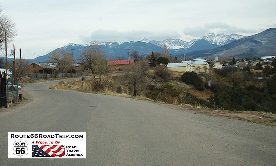
| Scene along the Turquoise Trail with snow-capped mountains in the distance |
 |
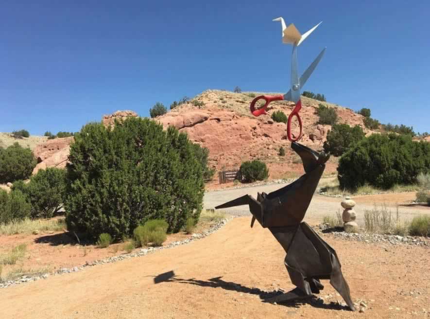
| Art work and sculpture on a beautiful blue-sky day along the Turquoise Trail |
 |
Lodging Options in the Turquoise Trail Area
Turquoise Trail Travel Guide and Lodging at TripAdvisor View hotels in Santa Fe, read traveler reviews and make reservations |
Map of the Turquoise Trail from Route 66 at Tijeras to Santa Fe
| Map showing the location of the Turquoise Trail in New Mexico from Route 66 at Tijeras northward to Santa Fe |
 |
Los Cerrillos, New Mexico
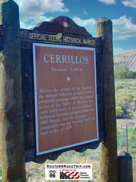
Cerrillos, Spanish for "Little Hills", began in the 1870s as a bustling gold and silver mining town. Today, it is now a quiet, tree-lined village with a population of 200, located 20 miles south of Santa Fe on the Turquoise Trail..
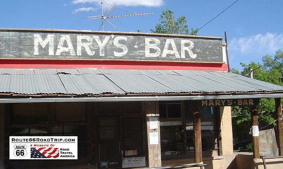
Historic adobe and western buildings line the dirt streets, including a bar and grocery, old opera house and St. Joseph's Church. Visitors enjoy the Mining Museum, Cerrillos Cultural Center and Petting Zoo. Be sure to take the self-guided walking tour around the village where signs are posted on many of the buildings, revealing the rich history of Cerrillos.
Another popular outdoor destination in the area is Cerrillos Hills State Park with its hiking, biking and riding trails.
| Mary's Bar in Los Cerrillos, New Mexico |
 |
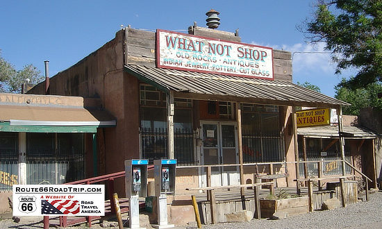
| The What Not Shop in Los Cerrillos, New Mexico ... old rocks, antiques, Indian jewelry, pottery and cut glass |
 |
| Scenic Historical Marker at Los Cerrillos, New Mexico ... Elevation 5,688 feet |
 |
Madrid, New Mexico
The village of Madrid lies in a narrow canyon in the Ortiz Mountains, along the Turquoise Trail. It originated as a coal mining town in the mid-1850s, and later became a ghost town.
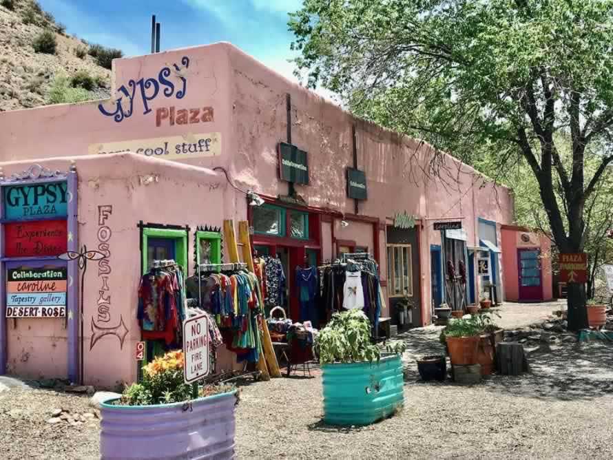
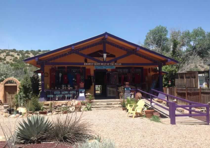
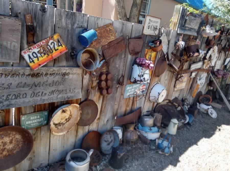
Today, Madrid is an active, creative community with over 40 shops and galleries, several restaurants, a spa and museum. In addition to its busy main street filled with merchants and artisans, it also features a quiet residential area.
Don't miss the historic Mine Shaft Tavern "roadhouse" with live music every weekend and the "ghost town" museum.
| Gypsy Plaza in Madrid, New Mexico |
 |
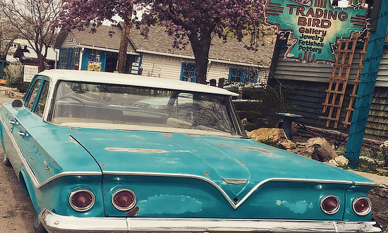
| Trading Bird Gallery in Madrid, New Mexico ... Jewelry, Fetishes, Pottery ... and the 1961 Chevrolet! |
 |
| The Great Madrid Gift Emporium ... "Cheapest silver west of the Pecos" ... in Madrid, New Mexico |
 |
| Madrid, New Mexico ... shopping extravaganza! |
 |
Sandia Crest National Scenic Byway
The Sandia Mountains are a small range east of Albuquerque, with its high point being a long ridge called the Sandia Crest at an elevation of 10,678 feet. Albuquerque lies about 4,500 feet below the Crest.
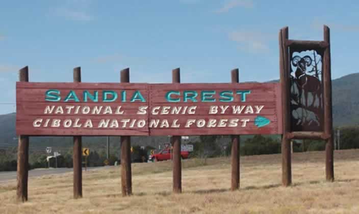
Access to the Crest from the Turquoise Trail is via NM Highway 536, the Sandia Crest National Scenic Byway. This paved road has many switchbacks and offers stunning views of the area countryside. The highway ends at the Sandia Crest which has a restaurant, gift shop, handicap accessible viewing, and toilets.
The Sandia Peak Tramway begins in northeast Albuquerque and travels to the crestline of the Sandia Mountains. It is the longest aerial tram in the United States.
| Entrance area to the Sandia Crest National Scenic Byway in the Cibola National Forest |
 |
Interactive Map of the Turquoise Trail Area
MORE NEW MEXICO ROUTE 66 |
||
 |
 |
 |
 |
 |
 |
More Information about the Turquoise Trail
Turquoise Trail Travel Guide and Lodging at TripAdvisor
Turquoise Trail Scenic Byway on NewMexico.org
Turquoise Trail Scenic Byway at VisitAlbuquerque.org
