Route 66 2026 Trip Planner
Map of Historic U.S. Route 66
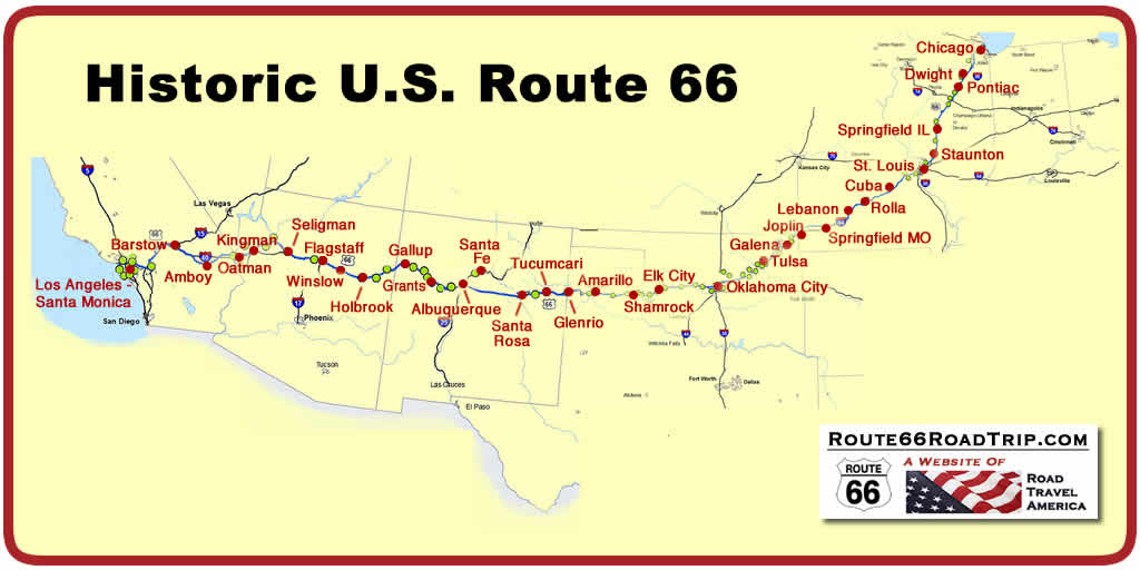
Route 66 Mileage by State (1926 Alignment)
State - Miles Illinois
- 301 TOTAL - 2,448 Miles |
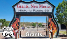
It's time to stop for a "selfie"! The arch in Grants, New Mexico on Route 66 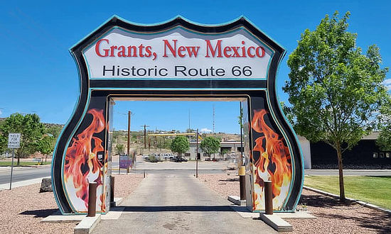 |
How long does it take to drive Route 66 from start to finish?
This question is asked often ... but is difficult to answer. Total time to drive the route, assuming no stops, is in the 32-38 hour range. But we would never recommend doing that. On some of our road trips across the USA, we drive 500 miles a day, or more. At that rate, we could drive the entire Route 66 in about 5 days. But we would never do that!
We like to take it slow, stop to visit attractions, and catch all those great photo ops on The Mother Road! As an example, on our recent road trip in 2022 on Route 66 in Oklahoma, Google Maps estimated travel time on our trip from Tulsa to Joplin, Missouri, to be 1:45 ... but in actuality, it took us 8 hours! For leisurely trips on Route 66, many experienced travelers recommend planning for 200 miles a day, at least on those stretches with lots of attractions, like Illinois and Arizona. At that rate, the trip across the entire length of Route 66 would take 10-12 days.
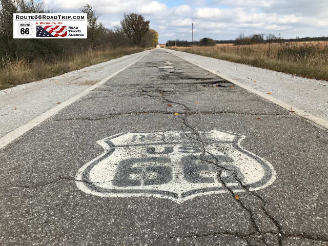
Ideally, plan on a minimum of 10 days to make the trip from Chicago to Los Angeles. However, for a more leisurely and complete trip you might want to plan for 14-21 days, or longer. It all depends on how many stops you take along the Route, side trips like to the Grand Canyon, and of course the weather.
 |
When is the best time to travel Route 66, weatherwise?
Route 66 travels through vastly different climates, from the mid-western plains and cornfields to dry, arid areas in the west, from near sea level in California to the 7,000 foot peaks along the Continental Divide. Thus, weather conditions are diverse, and sometimes unpredictable.
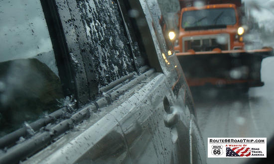
Travelers will on occasion experience snow storms, dust storms, thunderstorms, flooded roads and high winds. So watch the weather forecasts, and adjust your itinerary appropriately.
 |
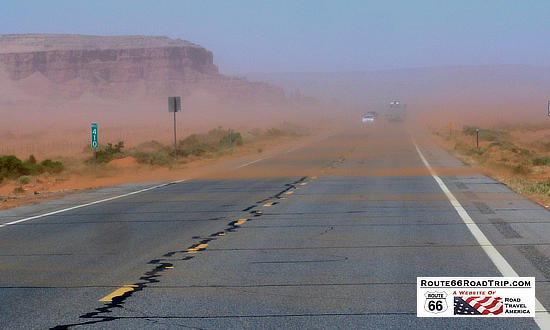 |
All factors considered, the most ideal weather for the trip is in the spring, from March into early June. Likewise, the fall months of September, October and November are typically pleasant and offer good driving conditions. Winter months in the north can produce ice and snow storms, while summer in the desert areas of the great Southwest can be hot, and often above 100 degrees.
![]() Read more about Route 66 Weather
Read more about Route 66 Weather
Which Way to Travel ... West or East?
The beginning point for a Route 66 road trip could be either Chicago or Los Angeles, depending on the direction of the trip. Most travelers seem to start their journey on Route 66 in Chicago, and head westbound, the direction taken by those leaving the Dust Bowl and those seeking a new life in the West. That is the direction we take on this website.
Route 66 Travel Planners for States and Cities Along Route 66
Here are trip planners and "must see" attractions for all eight states and many cities ... click any image or link for details!
|
||||||||||||
|
||||||||||||
 |
|
||||
OKLAHOMA ROUTE 66 |
||
 |
 |
 |
 |
 |
 |
 |
 |
 |
 |
 |
 |
 |
 |
 |
|
||||||||||
|
||||||||||
|
||||||||||||
|
||||||||||||
TRAVELERS LOVE THESE ROUTE 66 FEATURES |
||
 |
 |
 |
 |
 |
 |
 |
 |
 |
ALWAYS POPULAR STOPS ON ROUTE 66 |
||
 |
 |
 |
 |
 |
 |
 |
 |
 |
 |
 |
 |
 |
|
| Chicago, Illinois | Joliet, Illinois |
| Pontiac, Illinois | Bloomington, Illinois |
| Springfield, Illinois | Litchfield, Illinois |
| St. Louis, Missouri | Lebanon, Missouri |
| Springfield, Missouri | Joplin, Missouri |
| Tulsa, Oklahoma | Oklahoma City, Oklahoma |
| Yukon, Oklahoma | Weatherford, Oklahoma |
| Clinton, Oklahoma | Elk City, Oklahoma |
| Shamrock, Texas | Amarillo, Texas |
| Tucumcari, New Mexico | Santa Rosa, New Mexico |
| Santa Fe, New Mexico | Albuquerque, New Mexico |
| Grants, New Mexico | Gallup, New Mexico |
| Holbrook, Arizona | Winslow, Arizona |
| Flagstaff, Arizona | Williams, Arizona |
| Seligman, Arizona | Kingman, Arizona |
| Needles, California | Barstow, California |
| Victorville, California | San Bernardino, California |
| Arcadia, California | Santa Monica, California |
Interactive Map of Route 66 States, Cities and Points of Interest
Shown below is an interactive Google map of over 200 popular cities, attractions, motels and points of interest along Historic Route 66.
Is this all of them? Certainly not, as there are literally thousands of places to see along the Mother Road! Hopefully this map will help you plan your next Route 66 road trip.
Zoom / pan map for more detail, and click on icons for information on points of interest and photos. Click on this icon You can enable/disable the following layers by checking/unchecking the layer in the left column of the map... |
|
Route 66 cities and towns |
Attractions and points of interest |
Museums |
Classic motels and lodging |
Classic service stations |
Classic drive-ins, cafes and restaurants |
What time zone is Route 66 in?
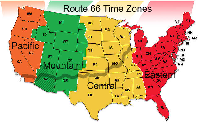
Portions of Route 66 are in three time zones: Central, Mountain and Pacific, as shown in the map below. Daylight Savings Time (DST) is observed from the second Sunday in March until the first Sunday in November. Arizona does not observe DST, with the exception of the Navajo Nation, so check for local time depending on where you are in Arizona.
 |
How can I find Route 66 segments today? What books & maps are available?
Many states have a system of well-marked signs, directing travelers on/off the segments. Also, there is a wealth of paper-based books and maps today that mark Route 66 segments, like the popular "EZ66 Guide for Travelers" and "Here It Is": The Route 66 Map Series" offered at Amazon and other outlets.
Popular Route 66 resources for your next road trip! |
|
Route 66 Travel Guide - 202 Amazing Places
by Mark Watson |
Route 66 Full-throttle Adventure Handbook, by Drew Knowles  |
| EZ66 Guide for Travelers (5th Edition) by Jerry McClanahan 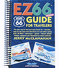 |
Here It Is! Route 66 Series of 8 Maps by Jerry McClanahan and Jim Ross 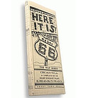 |
| Rand McNally 2026 Road Atlas Large Scale Spiral Bound  |
The Best Hits on Route 66 ... 100 Essential Stops on the Mother Road, by Amy Bizzarri  |
About These ProductsThe Route 66 Road Trip website is a participant in the Amazon Services LLC Associates Program, an affiliate advertising program designed to provide a means for sites to earn fees by advertising and linking to Amazon.com and affiliated sites. Amazon offers a commission on products sold through their affiliate links. There is no additional cost to you. |
|
 |
|
